
Wednesday, July 1: Amazing to think that we’re just…and I mean JUST past the half way point in Xing the US! We’ve been at this about 2 full months at and we’re about 50-60 miles from the CO border. Going to be very interesting this next month, seeing that I have several passes to X in CO and at least one significant pass in UT.
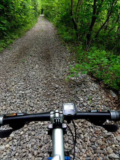
Well today was interesting, in three respects really: first, I came front and center with the dreaded sand burs today; second, I’m finding more and more that gazetteer, gps and maps are not without fault out here; and third, the heat is just off the charts. So Judy was awesome in that she really tried to help me get out there this morning early so we could be the heat - forecast is for 101-103 degrees later today. And I can actually say “we got out of Dodge” nice and early, with me getting on the bike at about 7:10 AM. I got rolling on Wildfire Rd west. The wind this morning was pretty stiff and gusty out of the west, so my speed was damned low, like about 8-10 mph max. Then there was that constant false flat thing going on, as I’m getting ever so closer to the Rocky Mts. I took Wildfire to 105 Rd, where I rode north for 3 miles of berm.
Now originally, in my itinerary, I had myself doing this south to west to north thing to totally avoid any kind of asphalt and berm, which is what 105 Rd is. But at this point, with us being about 3 weeks behind schedule, I have to try to trim mileage when I can. This berm move was just that. I did the 3 miles of berm north to avoid doing 8 extra miles of riding - this by having to go 4 miles south, then west, then 4 miles back to the north - just to pick up where I got off with the berm ride. I then picked up Warrior Rd west and took that to the junction with 24 Rd to meet Judy for a first check-in kind of thing, just to be sure we were both good. At that point we entered Grey Co and Warrior turned into CC Rd.
I decided to make the check-ins much closer today because I knew I’d be meeting up with my old nemesis from my 2012 American Dirt effort - the sandbur (you can read my blog on this from 2012 by copying and pasting: http://ad2012petegladden.blogspot.com/ Yup, I now know what to look for now, and I was looking for it yesterday, but saw nothing. Today I really figured that I’d begin to see them, and with me riding on the 29er with just the liners inside, I don’t want to get too far out and flat with umpteen punctures. Go through one patch of those and tire and tube are shot. I have a second bike with me on this trip, a 26er that Steve Thomas had built special wheels and tires for the sandbur issue, but I want to use that when these pups really get thick and I get totally shut down on the 29er. That 26er is just an antique by today’s standards and it’s suspension is meager compared to my 29er… plus with those monster tires, liners and rims, this thing is a tank!
I used that 26er last year on recon in CO, and purposely rode it through patches of sandburs to find out if Steve’s special wheels would work - and they did. So I’m comfortable with going to that Litspeed Unicoi when the situation dictates - but not quite yet! So anyway, I wanted to kind of check in every 10-15 miles in case I ended up with 2-100 of these bastards stuck in my tires. Got going on the next section on CC Rd and in a mile it just disappeared into a farm field. So again, my Garmin 810 WITH A FREAKING $100.00 MICRO SD CARD OF TOPO USA 24K MO/KS said that the road just kept going west. My gazetteer said that the road continued west…but let me tell you it does NOT continue west! So I had to go L, south on 23 Rd, R, west, on DD Rd, then R, north on 22 Rd, and then get back on CC Rd west. So there was an additional two miles of riding.
Got rolling again, and I’d been checking the vegetation on the side of the roads looking for those sandburs, and that’s when I spotted them. They’re these little plants that grows horizontally across the ground and they have these seed pods with spikes on them. The patch I found contained wet, or not dried out and dead, seed pods, which are a bit innocuous to the tires. It’s the dry, dead ones that are like tacks! But at least I knew I was now in sandbur country and to be aware of, and to look at my tires often - and to now Baha through highly vegetated tracks where the sandburs are as thick as briar patches.
Again, CC Rd kind of died out a couple times despite the fact that the road signs, gps, and gazetteer say that there’s a road there. This time it was a faint dbl track that I could ride on which was bare earth in two tracks and vegetation in the middle. I held my breath and began to traverse it, staying totally away from the vegetated part in the middle. I mean there were times where I just felt like I was riding right through the middle of a wheat field with nothing but this dbl track running down the middle for 1-2 miles. There were other times where CC just looked like this giant set of ruts running east west. But by God, every mile I’d come to the junction of a north-south trending road and the road signs. It’s just amazing. These roads are not maintained, and they’re more like farm access and that’s it. I doubt if regular vehicular traffic every even touches a road like CC.
Well, I made it to the south side of Montezuma, where the road went asphalt for a mile, to which I road some very easy berm, and then it turned back to gravel. Again, I rode the berm section to eliminate another south to west to north to west thing, and that saved me another 4 miles. Met Judy at the junction of CC and Rt 56. Ate, drank 40 oz of fluids and got going again on CC west. And once again, I’d hit a mile or two where the road just went from sandy gravel, to earthen, to a pair of wagon wheel tracks through farmland. BUT still, I had bare earthen track to ride, and NOT the vegetative stuff I got into trouble with back in 2012. Back then I’d come out of a vegetative track with over a hundred sandburs stuck on my my tires. Xed over into Haskell Co, and CC turned into 110 Rd.
Went L, south on WW Rd because 110 supposedly died out - and I didn’t want to test that one out - but then again, hell, maybe there was road there just like there wasn’t road where it was supposed to be in the other instances! So junctioned with 120 Rd west and took that. I was supposed to meet up with Judy at the junction of 120 Rd and Rt 83. But once more, 120 just kind of turned into this nothing of a little dbl track through corn and wheat fields. But I rode it, with the road signs and my gps saying that I was indeed on 120? I swear this is the funkiest riding. Seems all the east-west trending roads are just these earthen farm access roads, and all the north-south trending roads are more of main gravel roads that have farms situated on them. ZERO farms on many of the east-west trends out here.
At this point in the day, about about 12:30-1 PM, the temp was lost to 97-98 degrees, but the wind had changed directions out of the northwest so that made my riding a good bit faster despite the fact that I was riding on earthen roads almost exclusively. Now this final section was the kicker! I continued on 120 Rd after meeting with Judy and getting in another 40 oz of fluids, rode for a mile and the damned road just went into dbl track, and then it became a dividing line between wheat field and corn field. By that point I was a half mile into that 1 square mile quadrant, so I figured I’d just ride the dividing line for a half mile and see what the next quadrant would be. Go about 4 pedal stroke in and saw the front tire with about 8-10 dried sandburs stuck on it. Stopped immediately, pulled all the burs out of the front, pulled all the burs out of the rear, turned around and carried my bike out of that section back to the dbl track, and then rode like hell back to the east to the last X road.
I was ok, as I hadn’t put any weight on the wheels to really force those burs deep into the tires. I got on TT Rd south and took that to the junction with Rt 160. Checked the tires for pressure and it looked like I avoided my first serious onslaught of the burs. Rode this totally crapass berm on 160 west about 3-4 miles, then got on GG Rd north, took that to see if 120 Rd would reappear, and it did. So I got on that, went L, west, and continued towards my meeting spot with Judy, the junction of CC Rd and 120 Rd. So I had CC thru GG to traverse west. It was great dbl lane gravel for about 2 miles, then it went back to the dbl track on earthen road bed. BUT it made it to the CC junction without another “drop off the face of the earth” thing.
Judy was just amazed as she couldn’t believe that 120 at that junction was even a road. It just looked like this little dbl track that went out into this vast expanse of wheat fields. We called it a day there. I got in 66 miles, and I THINK no flats, though I’ll be checking those 29er tires the rest of the day and evening for slow leaker flats from the sandbur encounter. We’re at a little motel in Ulysses, KS basking in the AC as the temp gets ever so closer to 100+ outside. Must have drank another 140 oz of fluids again. My altimeter says were at 3110 ft, here in Ulysses, so I gained another couple hundred ft over yesterday. So I’m really looking at the route now, to do more improvising to avoid sandbur areas, and to trim some mileage. Could be a real nightmare if the roads continue to end mysteriously as they have today. I just don’t have any reliable information. Tomorrow we hope to cross over into CO, and begin the next phase of the trip. Time for din-din and a beer. Late!