
Sunday, June 14: I know I’m beginning to sound like a broken record….but when in the heck is this monsoonal rain system going to get out of here? Rain began at about 5 PM last evening and continued to 7 AM this morning. It was just wild to listen to that on and off deluge last night. I was really thinking this morning that today would be a wash, and yet, as usual, the skies cleared and the sun came out…and the humidity was through the roof. Within about an hour we went from game over to game on.
Went back to yesterday’s endpoint, for the start of today. Now I’d completed the whole I & M, but actually, back in the good old days it was connected to the Hennepin Canal via the Illinois River with some portage route that today is long gone. So I had to come up with my own “bridge” so to speak, to stay off the pavement for this 16-mile stretch between the tow canalways. My options were three: paddle the Illinois, do the berminator thing, and take a RR feeder line. Option one was completely out, as these rivers are so swollen and angry right now it just ridiculous. Option 2 I knew from recon would be a real tough go because the berm is terrible. Option 3 was my clear choice - do the feeder line. As I’ve said in past blogs, I like the feeder lines because they carry little in the way of daily traffic. They’re used, but only occasionally. Still, that does NOT mean that I’m Mr. Legal doing this stuff. I just try to stay under the radar when I go this route. Today being Sunday, that’s even better because most everything along the feeders are closed and rarely does any train traffic use these lines on Sunday’s. So I felt pretty good about this long run on the RR today.
The end of the I & M is tucked right next to this feeder line, so I just walked the bike around this big Riverboat pond and - inconspicuously - over to this little fence, dipped around the fence along a very well trodden path, and bingo bango I was on the RR line. I rode this double track off to the left side of the RR line through an industrial district, and right out of La Salle and into the adjoining city of Peru. They’re both pretty much heavy industry down here along the Illinois River, so there were a myriad of little accessory lines that went in and out of factories and big mega-industrial joints. I just stayed high on the main line, about a block above these accessory lines and I was good. Most of the riding through Peru was on the double track along the main line, so at least I looked fairly kosher.
Once I got through Peru, the tracks split yet again into a higher side and the low side right up along the Illinois River. That’s when I chose the low side, with much better ballast packed between the ties and got it rolling. Once I left Peru I was just out in the middle of the woods for a good 12 miles, with the next town that I’d actually go through being Depue. Have to say that this was really quite nice, just me riding right down the middle on the RR, with the flooded Illinois River just lapping and churning some 50 feet below me to my left side. There were some barges parked here and there for a few miles, but as I rode further west that just ended. Saw: a couple of grey foxes X the tracks, deer by the 10’s, saw an eagle, red tailed hawks, turkeys and turkey vultures. I mean this was just out in the middle of nowhere.
The first 6-8 miles felt ok, but after that I kind of had to rest my hands from all the bumping by taking a really light grip on the handlebars, OR just ride one handed at a time. It’s much harder doing this on the hands, arms and shoulders than it is on the butt. Couldn’t really do more than 8 mph, and when I did, the effort just didn't justify all the energy and sweat I was expending, so I just backed it off and rode at a comfortable pace. Judy called me from Spring Valley, where I told her I’d meet her, and at that time I told her that I’d be there soon. But as I rode on and on and on there was no Spring Valley. That’s when I stopped and checked my gps to see that the RR really didn’t go INTO Spring Valley, but just down a piece south of the town. So I called her back and told her I’d already past the place, but I’d meet her for sure in Depue, where the RR went right through the middle of this small place.
The whole time riding along the Illinois, I was just amazed at the massive amount of flooding. I mean the river was at times just lapping at the bottom of the RR grade which is elevated probably some 10-30 feet above the river in places. I reached Judy in this little burb of Depue via a double track trail that’s on the left side of the RR line about a mile out, and I just followed this thing right into town. That way it looked pretty good with me not coming into town right down the middle of the RR tracks. Did a sandwich, Powerade, coke and water and hit it for the town of Bureau, an even smaller place than Depue if you can believe that. This was another 3.5 miles down the RR, and again, it was out in the middle of nowhere once you reach the other side of town - which is about a quarter mile!
Now I have to admit that this last 3.5 of riding down the middle of the tracks, that stung a bit. Heck I was just sweating like crazy with the hot sun and torrid humidity, and then my hands were just getting numb from the jostling for 2 hrs. Made Bureau feeling pretty thirsty and sore, but still, I felt pretty good to get that section in the books and get on with another “easy” little towpath trail. Did another 2 bottles of powerade and did a quick mile of berm, leading Judy to the Hennepin Trailhead just down the road from the center of town. We decided that I’d go about 17 miles down the trail because out here in the middle of nowhere land, this was the easiest access point for Judy to drive to. The logistics out here on this trail are much tougher than on the I & M. The roads getting to and from the canal trail are these little county roads. Now just before I got going this fellow told me that a bridge was washed out about two miles down and that I might not be able to get through because of the high flood waters. Judy and I decided to give me 30 min to either make it past the washout or come back, this because she had no cell service out here. So I took off wondering if I’d have to do another grunt traverse through a washout as I’d done yesterday. Even wondered if the flooding would be so intense that I couldn’t even ford the creek.
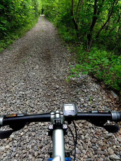
The beginning of this trail was kind of weird, as it’s this ancient asphalt that’s just so deteriorated that its asphalt gravel on both the right and left side of the trail and barely asphalt in the middle. So I just rode the gravel on either side of the middle. So I passed what looked like a new bridge over this creek, and tell you what, I’d NEVER have been able to ford Bureau creek if the bridge was still out. That stream was a raging river. But then came this washout of massive proportions, right where this park official was scoping out the damage. Bureau Creek had taken out almost the whole trail at a point, where the trail was just falling down into the creek some 20 feet below.
So I ride up to this guy and he says, “didn’t you see the trail closed sign?” And I had to play the Touron card (touron is a tourist moron), saying, “sir, I’m riding across the country and this is the only route I know, where else can I ride to get around this?” And that kind of settled the dude down a bit. He told me I could ride on this bulldozed area, then go on the horse trail, go around the washout, and then get back on the towpath again. It was a muddy mess, but hey, I let me by and all was good. That’s about when the trail went from the Precambrian asphalt to just like this hard pack sand, which provided a bit more resistance to ride on because the tire sinks just a smidgen. And I’ll have to say that for a towpath trail, this thing is just so NOT used. I mean I saw one bike riding the whole day, and this guy was back at the beginning of the trail. The rest of the ride I saw no one but fisherman at all the locks and bridge Xing’s. But zero with respect to runners, cyclists and walkers. And this was a Sunday.
What’s more this trail is not just flat, because it seems that up to each and every lock there’s this little power climb, and it definitely takes its toll on you after doing these things mile after mile. And today, most of the ride was on this sandy double track that is really way the hell out in farm country. Reminded me of the Katy Trail where you’re just a million miles from big towns and cities.
Made it to Judy with a bit of trouble as I came to our designated meeting spot, Lock 21, and she wasn’t there. So I called, and thankfully she had a signal. “Where are you,” I asked? and she told me she was right where we agreed. And I;m like, but you’re not, because this is Lock 21 and you’re not here! So she checked with some fisherman in her area and found out that I was at the Lock, but she was at the boat launch….about 500 feet down from me around a corner. Poweraded up x2, and got in one more quick segment to Hennepin Canal State Park and that was it for the day. The humidity was just so stifling today that I pulled the plug for both of us. I ended up with 40 miles with a late start, so I feel good about getting in miles, but kind of bummed that I couldn’t put in another 20 for the day. I keep thinking things will clear up here and I’ll be able to put in some big days, but the weather is unrelenting.
And guess what, it began raining about 6 PM and it’s still raining right now at 8:30 CST….unbelievable! Tomorrow I hope to finish the Hennepin and begin the long gravel road/berm ride south to the Mississippi River Xing. I fear, with this current storm pattern and all the flooding, that I’ll not be able to paddle the Mississippi. Better clear up very fast!