
Blog
Blog
Thursday, June 22: DONE! Yup, we made it to the Pacific coast today. And the way we did it was just how I envisioned it - well save for about 2 miles of pavement at the very end. But wow, what a amazing day. Our tracks was just stellar and the day was beautiful because it went for hellhole hot in Eukiah to cool and balmy on the Pacific coast just south of Mendocino.
Here’s how the day unfolded. Got up at a gnarly 4:30 AM to prep for today’s ride, what I figured to be at least 5-6 hrs in the saddle with 5-6K of climbing to finish this thing out. And the problem was that the forecast for Ukiah today was 108 degrees, so I worried, what with my predilection to folding in the heat, that such an itinerary coupled with the heat would just crush me. So we’d decided to get our earliest start of the trip in hopes of getting a big chunk of climbing out of the way early in the morning.
Anyway, got up and out of the motel at 5:30 AM, and at our end point from yesterday in time for a 5:50 start on Low Gap Rd. I started ahead of Dave because the guy ALWAYS catches me. Just made sense to get a good jump and go for it. Now I’ve a confession to make before I go any further… I bought some wine yesterday at the Parducci Winery to give my sister…and Dave and I polished off one of those bottles and one of my cheaper bottles last night. That in addition to eating at the 10,000 Buddhist place, and then at a Mexican restaurant last night. So between all that food and all the wine we drank, well, we were not quite in cycling shape in the morning. I felt downright crapass. Dave, for the first time in the trip wasn’t his normal self.
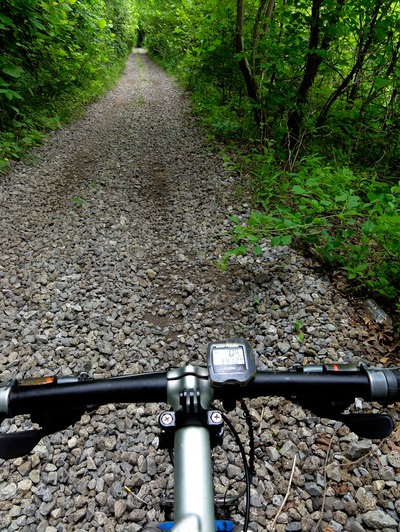
See we sat around the pool yesterday late afternoon in the 105-degree heat sipping wine and talking cycling and adventure. Felt wonderful at the time. But man, getting up and knowing you have a 50-plus mile ride ahead of you, on gravel, with nearly 6K of climbing - that had me a bit scared of the potential ramifications. So as I said, I started off probably about 15 minutes ahead of Dave. The climbing began right out of the parking lot, and I knew it would be a long, long, climb. The asphalt lasted about a mile and then the gravel began, and it just did this gradual up into the foothills for mile after twisting, turning mile.
So like about 30 min into the climb - no Dave. Forty min in - no Dave. And I was beginning to wonder if the dude had a mechanical or something. Usually he’d pass me within about 10-15 min. Finally, after nearly 45 min on my own Dave pulled up to me and muttered something about how he was feeling like shit. Poop or not, the dude was by me like I was a doorstop! And we climbed, and climbed, and climbed up Low Gap Rd. Now I timed this puppy and it took me 1:14 hrs to top out. But that didn’t mean the climbing was over. Nope, once up on the ridge we had this undulating track that was chock full of power climbs.
The beauty of this climb though was the fact that we climbed it almost completely in the shade due to our early start. Sun really never crested over the mts to hit us directly, and then when we did hit the top, it was completely enshrouded in foliage. That alone clipped some 10-20 degrees away from the temp. So we’d just meander on the ridge top for miles, climbing, descending, twisting and turning. Really that Low Gap track was really awesome, with zero traffic. Yea, it went from one-lane gravel to mostly dirt that was generally jeep track. The road seemed to go on forever. And it was towards the end of the track that I began to have issues with my Garmin download, a route I created on Ride With GPS and then downloaded onto Dave’s and my Gramins. I began getting these goofy commands about turning this way and that off of Low Gap rd. Finally, with Dave way ahead of me, I had this command to take a hard right at a jcn. There was a primitive house along the track with the track splitting to an easy right and a hard right.
The arrow on my Garmin indicated hard right. And I stopped to really kind of access the directions. Unfortunately I did NOT have a paper map with me, so I just sat there deliberating for a minute. Finally went with the hard right as the GPS indicated. The other track, the easy right, looked like it was part of the property of the primitive house. Took the hard right, went down to a gate, and there was some asphalt road that the Garmin indicated I take a left. Looked for Dave’s tire tracks off the dirt track - nothing. But I took the turn nonetheless.
Started riding in a western direction so I figured I was still good with the route, and then, about 5 min later my GPS started telling me to do a U-Turn, that I was off route. That got me feeling really confident about my situation. And then when I went to just the regular map on the GPS, it told me the name of the road I was on, and I had NO idea what the hell it was. Had a good picture in my mind about our route and the roads we’d be on, but THAT road was nowhere in the memory banks. I finally turned around and headed back to that jcn. Went back under the gate, back to the primitive house.
Then I heard this chainsaw, so I went up to the fencing at the primitive house and saw a guy coming around the corner of the house. Shouted out to him a question about Low Gap Rd., and he told me to continue on the soft right. That’s what I did and within about 1/4 mile I saw Dave’s tire tracks. So by that time my GPS was just acting like a disoriented robot, telling me to take these nonexistent tracks. I basically just turned it off in my mind and continued to ride the track by sight. After about 30 min Dave rolled back down the track to find out what had happened to me. We were both pretty relieved.
As we moved along on Low Gap we could feel these wonderful cool pockets of air, which told me we were getting closer and closer to the ocean. Not only that but the redwood forest we started seeing along the track was just spectacular. I mean most of these were what I’d call juveniles, but damn, they were so big around, and towering so high into the sky that they were astounding. Yup, we knew we were out of the hot box of the basin and nearly the cooler coastal environment. Man, just riding past all these elegant giants was amazing. What a way to finish the trip.
Continued on Low Gap and just climbed and descended ad infinitum. Seemed like the track was endless. After what seemed to be 25-30 miles of riding this track, we eventually popped out on an asphalt road, Comptche-Ukaih Rd. And we’d only cycled 17 miles! That took us about 3 hrs what with my directional gaff. Did a bit of climbing on the asphalt, then stopped for a quickie lunch stop, then continued on to the small hamlet of Comptche. This I knew for sure was where we’d have to make a left onto Flynn’s Creek Rd, but this time both of our Garmin failed to tell us to turn. Actually Dave almost rode by this primitive intersection.
I’d told Judy earlier that morning to meet Dave and I at the bottom of Flynn’s Creek Rd. down at the Rt 128 jcn., which was about 8 miles south of Comptche. So with both of our GPS’s spitting out wrong info, we did the left and rode the asphalt south. Had a good bit of power climbing and partial descending to get down to near sea level. Met Judy with a solid 5 hours of saddle time in by then. So at this point we were about 11 miles from the Pacific via Rt 128 which is asphalt and busy.
I’d programed the Gamin’s with a final gravel route west, Navarro Ridge Rd., but again, this failed to come up on the turn by turn screen. I even turned my Garmin off, then turned it back on, chose the route and it popped up, telling me we were on Low Gap Rd. That was it, something was corrupt with that route or download, or whatever. So I went on manual (I’m using a Topo US 24K chip that covers NV and CA) and bang, Navarro Ridge Rd pops up no more than 100 yards away from the van. So we decided to take the harder route to the coast via Navarro Ridge instead of finishing on asphalt 128.
So we told Judy to meet us at the jcn. of 128 and Navarro Ridge out on the coast. Then up we climbed, for about 3-4 miles and 1200 feet up onto the ridge. This track was just stellar, more of a jeep track that was cut right down into the earthen floor, where the thing was a good 4-6 feet deep down into the earth. The foliage on this track was again the massive redwood trees and all these lesser trees had the mosses hanging from them, indicating the foggy, cool environment we were entering. This track was just spectacular to ride, despite the fact that we were climbing our butt’s off for several miles.
Rolled up and down and up and down once we got on top of the ridge. The temp by that time couldn’t have been more than like 78-80 - and dropping with each mile we pedaled west! Gradually civilization finally began to appear on the track, and then with about 2 miles to go the track turned to a small 2-lane asphalt country road. That’s when we could see the Pacific Ocean off to our left, and then straight in front of us. Dave did some movie footage of me riding no-handed with a smile on my face that was wider than wider than a pizza pan. By then the temp was downright chilly, what with me wearing a cycling tank. Had to be about 60-some degrees as we descended down to the ocean. Ended up at the jcn. of Navarro Ridge and Highway 1 on the Pacific Ocean. Dave and I did the man hug thing, then Judy and I exchanged a kiss. We did it.
Loaded our gear and headed straightaway for Mendocino, which was about 8 miles north of our ending location. Once there we parked the van amidst a sea of tourist vehicles parked along one of the main thoroughfares in the town, and ventured out to find a place to eat lunch. Found an awesome spot where we were on a open balcony overlooking the ocean and had an amazing lunch. I think we were all on cloud nine, knowing we were done and we could just relax and smell the roses. After lunch we hit a gourmet chocolate shop for some “Tree Bark”, then got a room at the Little River Inn. Again, the wow factor just knocked us out. We splurged and got this amazing room that has a porch that overlooks the ocean, which is only about 100 yards away. Our view off the porch was of rocky outcrops and sea stacks being battered by the Pacific Ocean.
Next up was our ride down to the beach, about 3 minutes away and visible from our porch, where we did finish shots and movies of me and Dave doing the tire dip in the ocean, and then of both of us doing a full submergence in the cold Pacific. THAT spelled the official end of American Dirt. Went back to the room and sat on the porch drinking the second bottle of wine I’d bought for my sis (Kim, I’m buying you more wine today on our drive down towards San Fran), and then we did some dinner at the Inn.
And so ended an epic day. Again, I can’t tell you how much this particular part of the trip, after all the issues that plagued me last summer, has meant to me. It’s kind of told me that I have a very important part of my life back. Also have to thank Judy and Dave for everything they’ve done for me to make this happen. I’ll do a little prologue on all this tomorrow. So until then, I hope all you guys continue to chase your dreams.
Blog
Wednesday, June 21: Another day in the NoCAL bast furnace, but at least we’re starting earlier and earlier on each day. Got up at 5 AM this morn and got on the bike at 6:30 for our earliest start yet. Got rolling on the northern tip of Clear Lake and proceeded south on paved Lakeview Blvd. into Lakeport, then took a right and headed west on 11th street up to Scotts Creek Rd. This is the point where Judy left us, so we loaded our Camelback packs with water and food and bid Judy farewell until Ukiah, CA.
Scotts Creek Rd reminded asphalt for a bit longer and then turned to gravel, and it was still slightly residential - until we rode across Smith Creek, which at this time of year is a dried up riverbed of wash and stones. Once we crossed that creek it was game on, first with this steep as hell asphalt pitch that was easiest gear all the way. And I thought the climb had ended when it went back to gravel. Ha! Not a bloody chance. This climb was a kick in the gut that never stopped giving.
It just went on forever, and each twist and switchback was a pretty steep pitch that had me on the tip of the saddle, hunched forward, pushing the littlest gear I had, and thinking, “this has to be the crux of the climb with the end in sight. But be damned if I went around that corner or that switchback, and another series would be staring me in the face. Every now and then there’d be a lighter section where I could kind of regain my composure. So this went on and on and on and on, with no end in sight. Several times I really wanted to take a breather, but some point into that climb I’d decided come hell or high water I was going to get to the top of that with 1) no dismount, and 2) no dab or tap. This thing became my motivation.
So I stayed with it and tried to recover on the lighter gradients which are in the 5-12% range, and then pushed through the steep stuff which is in the 19-20% range. Dave later told me this thing went about 600 feet of elevation gain per mile for 2 miles. Eventually the grade mellowed out to the point to where I really did begin to believe that the climb was over. Finally Dave rolled down towards me which told me the climb was, or soon would be over.
As I told him at the top, this damned that became my personal challenge, especially having gotten such a beat-down in the last couple days where the heat’s been thrashing on me. From there we did a series of rollers up on the ridgeline, then over one more small pass, and finally down, down, down, for a massive long descent into Talmage. The last part of that descent was a monster rollercoaster through this tunnel of trees.
There was a point where I started seeing a bunch of No Trespassing signs along the road, and it made me think whether or not I was on a wrong track. But even at that point I was NOT about to ride back up that behemoth to see if I was wrong. Nope, I was bloody descending back down to wherever I came out. Turns out this was the right route and I finally arrived, via a steeply descending asphalt roadway, in Talmage. From there I rode into Ukiah and up to Low Gap Rd to our finish point. Not more than a mile up the road was Judy parked in a skatepark with Dave at the van. Day’s ride was a success. From there we were off to the Parducci Winery for a little wine tasting. Ended up getting a couple bottles of wine, and for me, spending 30 bucks for a bottle of wine?????? Whoo. I’m no wine guy but I thought the very least I needed to do was to buy some local Mendocino County wine as a little pat on the back for the effort thus far. After that we went to a Buddhist monastery for lunch. Yea, we heard that there’s a vegan restaurant in Talmage at the monastery, so that was our gameplan for the last couple of days. It’s called the City of 10,000 Buddhists Dharma Realm Buddhist University. In a word…AMAZING. The food was so great. And we ordered a ton of stuff, 3 appetizers, 2 soups, and entrees. The place was just off the charts. I think we ALL left with Buddha bellies.
Back here now staying out of the heat at the Day’s Inn where it’s like 105 degrees out there. So looks like one more day to get to the coast. One more day. Really don’t know what to say or write at this point so maybe over the next couple of days I’ll figure it out. Until tomorrow
Blog
Tuesday, June 20: No meltdown today, but I have to say that the prior two days really took it out of me. As I described it to Judy and Dave, I felt as though I’d just woken up to a horrible hangover, with headache, sick stomach, lethargic body, the works. And mulling over the prospect of another ride in that freaking Suzie Homemaker Oven heat, that was analogous to getting up to face the gallows. I know…I asked for it, I planned it, and I wanted adventure. Yea, I got it all right.
Slept like crap last night, maybe getting like 4-5 hours of sleep, that on top of being KO’d from yesterday. So I got up feeling awful. Now I was able to eat last night, actually I ate pretty well, and I’d thought that would put me back in a good place. No luck there. I had half a subway sub from last night, so I ate that for brekkie. We got out of the Travel Lodge hellhole bright and early at about 6 AM, and got back to our ending point from yesterday by 6:45. Now that drive was almost ALL down mountain, so our first 18-20 miles of riding would be up paved Rt 20 to the Rt 53 jcn.
I kind of got ready solemnly, knowing what lay ahead with the way I was feeling. Took off before Dave cuz I knew that he come flying by me like the tortoise and the hare. Started straight into a steepish climb. Just put it in the little cookie and did what I could to survive my way up the climb. Temp by then was probably about 80. By the time Judy had stopped at the first support stop, about three miles into the climb, I was soaked. Now I’d though I drank a ton of liquids yesterday, like 7 16-oz drinks, and yet I was still a mess, so I thought I’d go a bit less on the strength of the Gatorade but drink more total liquid volume today. My goal was to down a bottle before each support stop, which was going to be like every 3-5 miles.
At the first support stop I told Judy that the day was going to be a VERY long one indeed. Nothing was there. Got refueled and continued on the mission to “simply make progress”. Now on the second climb, that felt just as miserable as the first, and that was the one that made me think that I’d better make a change to my itinerary or I could quite possibly be cracking again for the third day in a row. So at the next support stop I told Judy to convey to Dave to go ahead at the High Valley Rd turn-off without me and do the gravel portion of the ride. I’d just stay on Rt 20, which parallels High Valley. Pretty simple decision actually, I mean I did not want Dave to have to drag my sorry ass up and down the backcountry like he did yesterday, and worse yet I didn’t want to temp fate and meltdown out in the backcountry again feeling as I was today. Figured I’d just stay on Rt 20, that way if I did move closer to another meltdown I could pull the plug immediately having Judy close at hand with the van. She drove up the road to tell Dave of my plans.
Made it up to the third support stop, and that’s when I became a “believer” in eating pickles and drinking pickle juice for electrolytes. Now I’ve heard this before from some of my ultra-distance clients, but the thought of munching on pickles and drinking the juice - gag me! Well, Dave’s a big believer in the pickle and juice thing. So as we’ve been going along here, I’ve ate a pickle or two before and during our rides, but today….hell, I totally dived into the pickle jar. Today I became a full-fledged pickle convert, a cycling pickle lover. Because today I just craved those damned salty pickles, and I was even more desirous of drinking the cold juice. Yep, I actually felt somewhat better as the day went on what with my pickle munching and juice drinking.
By the time I hit the Rt 53 jcn. and then got up to Clearlake Oaks, I was at least feeling like I could continue the ride. And what really made things better was that when I got up to Clear Lake, the biggest fresh water lake in CA, the breeze out of the north right off the lake was nice and cool, like cool, cool. Man that made all the difference in the world. Stopped a couple more times for support, but by that time I knew I’d make it without a bonk or meltdown. Rode through Lucerne, then Nice and finally got to Upper Clear Lake where Dave was supposed to come out on the backroads.
By this time temp was in mid 90’s, and I could definitely feel it. So I waited under a tree at the jcn. of Upper Lake/Lucerne Rd for both Judy and Dave. Judy came by first, so we loaded my stuff and then drove up the road. Problem was - it was a loop road surrounded by private, gated ranch roads. This got me a bit worried about Dave, with what happened to us yesterday climbing over gate after gate.
So then we decided to go back south to Barltett Rd, which definitely drops off of High Valley Rd. So if Dave had some problems, that would be a good road to get back down to Rt 20 on. On the way Dave called, telling us he indeed descended down Bartlett and was waiting in Nice. Mission accomplished. Dave said the initial climb on High Valley was a doozie, like a couple K of elevation gain. Honestly, I probably made the right choice by forgoing the backroads section today.
We’re chilling in a local little motel in Lakeport, on the west side of Clear Lake, right now, with the AC cranked at 68. Washed my two days of cycling kits in the sink and it’s all hanging on the van right now. I even got Dave to join in on the Beverly Hillbillies thing by hanging his cloths on the van. Looks great out there with cloths blowing in the hot wind.
Hoping today being a non-cracking day will bode well for the next two days, which are supposed to sky-rocket back into the stratosphere with high temps. This heat wave is going to follow us all the way to the Pacific.
Blog
Monday, June 19: Meltdown take 2! Yea, this amazing heat is royally kicking my ass. But I’m ok, and just to make my sister feel good I’m telling her that I used my head, I backed off when I needed to, and I didn’t push over the that thin red line. There you go doc! I’m listening - for once.
All right, got up and moving at 5:30 AM and was out the door at 6:30 in the van for our drive back to yesterday’s finish. Got there and was on the bike at 7:15, and it was hotter this morning than it was yesterday morning. Now Dave stayed with Judy for a bit to get some work done because he did this section yesterday. So I took off solo for the ride’s first 8-10 miles. And damn, I was just sweating from the get go. Knocked down a tall bottle of Gatorade and some Enduroyltes by the time Judy and Dave got up with me. Stopped, Dave jumped in while I refueled. Now along the way, I was getting eaten alive by these biting house flies. So I opened the door and some 10-20 of those harpies went inside.
Judy raved about all the flies as I was mixing my drink, and that was it - those pups were with her for the rest of the day. Okay, we went through Colusa, and then got on a host of gravel and asphalt roads south and west past I-5. I was knocking down over a bottle of liquid per hour as we got up to the foothills that would take us out of the Central Valley basin. Did a 2.5 mile climb on asphalt and then stopped at Old Wilber Rd to begin our grunt session through the foothill. Judy had done support up to this point, but we were on our own from there forward.
Both of us put our Camelbacks on, each with about three tall bottles worth of water per bladder, and we took some solid food. Now the first issue was that Old Wilber Rd was gated and locked. There were no signs indicating No Trespassing, so after some deliberation we decided to go for it. Hoisted the bikes over and off we went, through some really beautiful foothills country, covered in gold from the vegetation glowing in the sun. Then came a second gate, this one with a Private Property: No Trespassing sign on it. More deliberation. We had no service and really no choice but to move on.
So we past this little ranch hand lot with some trailers, a car and a ATC. Yelled out for anyone, but the place was vacant. We continued on. And again, the scenery was really awesome - save for the nearing 100-degree temps. All was honky dory for a bit….until we rounded this corner and ran into a whole different roadway - this freshly graded mess that resembled a dried up creekbed. And in fact is was right next to a dried creekbed. this suddenly changed the game for me. The surface was just a thick, unconsolidated jumble of dirt and rocks. Not easy stuff to ride on for sure, at least for me. Dave looked smooth and comfortable as I was working pretty hard to hold a line on the one of two tire tracks on the road. Get off one of those tracks and you’re kind of washing out the front and or rear wheels.
Now under different circumstances, it would have been hard, but pretty doable for me, but with nearly a hundy degrees, it was just zapping me of energy. And the really gnarly thing was that this thing was gradually climbing. After a couple miles of that I was just getting pounded by the heat, just mashing through this loose shit, trying to hold a line, trying to stay upright, trying not to crack.
Once this thing began to pitch up at a steeper gradient I really felt like I was getting into deep doo-doo. It was as if a hammer smacked me up aside the head. Good gosh, I mean my energy level went from ok, to E in a matter of a mile or two. It was as if I could see my fuel gage moving to E in fast forward. Finally, when Dave told me his Garmin indicated we were doing a steep climb - I had it on mine but I was too fatigued to even look at the profiles - I knew the jig was up. Like as soon as it pitched up steeply, with all this loose dirt and rock I just couldn’t even keep it rolling. Like it was taking way more energy to hold a line and and climb than it should have been. I finally just about fell off the bike in fatigue. That’s when I began the long walk, the walk of desperation.
I just pushed the bike as Dave disappeared over switchback after switchback. I’d stop every so often to kind of catch my breath and let my system settle down. Then, with lower HR and exertion level, I’d continue onward pushing the bike up the mountain. After about 10 minutes of this I saw Dave walking back towards me. He took my bike and pushed it to the top as I staggered behind him looking like a freaking drunk. We stopped once so I could rest, then we continued. Man, I have to say that Dave really saved my ass. I was the walking…well, not going to say it. Bad karma. But what he did was awesome. So we got to his bike, but the climb continued up another steep switchback pitch. Dave rode his bike up that one then came back down for me. I joked to him that “little did he know that he’d be a nurse maid for me”.
We got to the top and I was thinking, “if this loose shit continues, and there’s more climbing, I’m done, because in essence I WAS already done.” I didn’t want to worry Dave, but I kind of knew my new set of limitations, and I was beginning to push the envelope. Okay, we descended down the loose crap for a bit and then came to like the 5th or 6th gate on this stretch of track. Hoisted our bikes over this guy and we saw our next track just down the road, Bear Valley Rd. Luckily the remainder of the Old Wilber Rt track was just vegetated instead of freshly graded. And I’m telling you, that graded road was as if dump trucks had just poured that crap onto the track.
Descended down the rest of Old Wilber and got on Bear Valley, which is nice hardpack gravel. The riding was easy, but I was toast. And I had to stop several times under shade trees to regroup, let the HR come down and the breathing to settle down, then move on again for a mile or so. Did this for several miles. I’d sucked down my entire Camleback bladder in just Wilbur Rd, so Dave gave me some of his water. I finally told him to go on and get Judy, since the gravel road was totally drivable. I figured this way he could move on without my stopping him each mile, and Judy could get me some cold water and nourishment so I could finish the ride.
Took a couple more rest stops in the shade as I plodded on to the jcn. with Rt 20. I’d feel okay for a bit once I got going, then within a half mile the heat was just blazing again. It was like being in a convection oven. Judy rolled in with about 2 miles to go. Got in the van with the AC just hammering away, drank a ice cold Coke, had water and tried to regroup for the umpteenth time. Rode the final 2 miles without my pack and without helmet - it was like having a hairdryer on my head with this heat.
Made it to the Rt 20 jcn. and that was it - 42 miles in like 5 hours. Again, Dave helped to get my bike strapped in while I sat like a blob of protoplasm in the front seat.
Now we had reservations at the Travel Lodge in Clear Lake, CA, but when we got there they told us we couldn’t get in until 2. So we went to a place called The Spot for lunch. All of us got salads, with me doing all I could to get the stuff in my ugly feeling stomach. Salad was great, but my gut was just feeling pretty nauseous from the ride. Then, when we went back to the motel, all sort of shit hit the fan, like the booking place that did the room reservations didn’t give us a room with two beds, and the Travel Lodge wouldn’t change anything because they claimed our reservations were for one bed. With me a slightly comatose mess, Dave took over the angry dude role and began lecturing this young dude about customer service. We F’ed around with the motel and the booking co. for I don’t know how long. Plus, with this booking co., we had a NO Refund on this thing. So we just couldn’t pick up and move to another place.
Dave, good natured guy that he is, finally settled with giving Jude and I the bed while he sleeps on the floor in his sleeping back. The motel staff was just determined to hold the line and give us what the booking co. booked.
Now I’m feeling better, but I’m still a bit on the weak and knackered side. Feels like I did a race. Funny too, because with this heat wave going on out here I adjusted the segments down in mileage, yet this 42 miles just smoked me today. Now I have to admit that some of that was due to the horrible surface on Old Wilbur Rd. That was an energy black hole that nearly drew me past the Event Horizon.
Well, that was the drama for today. I’m still kicking and still working to get this pup in the bag. Again, many, many thanks to Judy and Dave to helping me though this tough day.
Blog
Sunday, June 18: Man, the heat kicked me in the ass today, plain and simple. I’ve always had a bad track record with really hot weather, which hell, goes all the way back to my first state road race in like 1979-1980, somewhere in there. Think it was a hot, humid summer race of 100+ miles, and I blew a gasket about 60 or 70 miles in, ending up with a dnf. Man, I remember just slinking in on fumes, all lethargic and out of gas, problem even had a slight headache.
Today brought back those memories for the dark ages for sure. So our day started out early, what with the forecast calling for temps to soar into the 108-110 area by early afternoon today. We did a quick much, then loaded the van for our start. Got to yesterday’s end point and we were on the road at 7:30 AM, or earliest start of the trip thus far. I think we were in the mid 70’s by then, so things were pretty comfortable for the start. Now as I said yesterday, most of the riding through this Central Valley area is asphalt. Just barely any LEGAL gravel because of all the agriculture, because this IS one of the agricultural breadbaskets of the USA. There’s orange farms, peach, apple, lime, lemon, veggies, you name it, it’s all growing out here for mile after mile.
Yea, there’s plenty of miles of gravel, but it’s all private property access roads that meander around cropland. So we’re left with asphalt. Now we do do gravel berm out here in the Valley, BUT we absolutely cannot ride on vegetative sections of berm because of all the goatheads. I mean they inhabit this area like nobody’s business. I even stopped, just after curiosity, to see if there were actual fresh “burs” on the plants. Didn’t take but one look at one plant to confirm that suspicion. There was green, burs still on the plants. Usually it’s the old, dried, dead seed pods that cause all the trouble with tires, but the green bur that I picked off seemed just as deadly.
I had warned Dave prior to picking the green bur, so as he rode ahead of me he knew not to ride into specific sections of berm. So we went north on Rt 70 fighting a steadily increasing headwind out of the north, then west out of Gridley on Colusa Hwy. road for a good 15 miles working against a crosswind.. Did a few more jig jags and we were riding south on River Rd, which parallels the Sacramento River, where we had a wonderful tailwind. So about this time I was starting to feel the heat. Matter of fact when we went through Gridley, I saw a Time & Temp sign that read 86 degrees, and then just as I got to it it read 87. I joked to myself that as I passed by the sign it probably changed to 88 degrees.
Anyway had to be high high 90’s by the time I got rolling on River Rd. Met Judy at the River Rd jcn. and told her I’d be slowing down due to the heat, just enough to kind of save some energy. Told her I’d meet her down the road about 5 miles for a hydration stop. Off I went, and much to my surprise there in front of me was this amazing levee on each side of the river, and it sported a nice one-lane gravel road. So I checked this sign on a gate and it indicated that no MOTOR vehicles without permit allowed on the levee. Didn’t say a word about bikes!!!!!
Go on the levee and took that pup of all it was worth. Only issue was my having to stop to hoist my bike over the gate every several miles. Finally had a section where I had to het on the road to bypass a stream, and luckily that’s where I saw Judy, who had been up and down the road looking for me as I was riding on the levee. Sometimes it meandered out away from the road, so I was kind of MIA for a bit. Got more Gatorade, and told her I’d meet her in town, which she said was just a couple miles down the road. Got back on the levee and continued the ride to Colusa. Now the levee kind of died out for a bit, and as my Garmin was readjusting because I was “OFF COURSE” during the levee ride, I made a fatal error - I went straight along the river instead of turning right on this bridge into Colusa. Once my Garmin readjusted I seemed to point my down the road, so I figured there was another bridge, and continued south on the road hugging the river.
By this time I was really feeling the heat. Stomach was feeling upset and my head was starting to feel achy. Kept rolling thinking that bridge was right around the corner, and what really wrangles me is my Garmin seemed to say I was on course - until about 4-5 miles down the road when it began flashing “DO A U-TURN”. That’s when I began to think out loud WTF! Went a bit further and finally I stopped a couple guys in a truck, like I was out in the middle of the bloody road. Asked them which way to Colusa, and be damned if they told me it was back up the road I’d just ridden, 4-5 miles back up the road.
Man, I was just loathing turning the bike around and riding 4-5 miles back up the road into a headwind. Felt like shit from then onward, just doing my best to keep the pedals moving. My thought was that Judy and Dave would be looking all the hell over Colusa for me, when I was off on a totally different road that they may not even get on. Had to ride to that dang bridge into Colusa. Tell you what, you remember certain tough rides in your life, and this was one of them for me. My Gatorade was hot, my mind was beginning to drift in and out of reality, and my legs just felt like pillars.
More than a couple of times I wanted to just stop at the side of the road under a shade tree, but I absolutely had to get back to Colusa some the gang wouldn’t be driving all over hell’s half acre. The miles went by way too slow, but I finally got to the bridge, barely had the gas to get out of the saddle to cross it, then when I did I saw a nice shade tree at the other end. That was THE end of the day for me. Got off the bike and just kind of sat there for 5 minutes. Man I was beat. Decided to just stay put and wait it out for Dave and Judy. Luckily they came by another 5 or 10 minutes later. Dave loaded my bike on the bike rack and gave me a ice cold washcloth for my forehead. Drank about 2 16-ounce ice waters and just sat in the van.
Now I’m sure my sister is like ready to read me the riot act, but honestly, I pulled the plug before I got myself into deep do-do. I know what heat does to me, and now, with the past year’s issues, I’m not going to tempt fate by pushing too far into the hurt locker. Got to respect the limitations. So we loaded up and headed back to Yuba to the motel. Dave finished the segment, while my Garmin tells me I’m 12 miles from the finish. I ended up with 49 miles, but 10 of that is off course.
Got back to the motel, lay down for a bit, and I’m feeling much better. Have to thank Jude and Dave for all their support today. Man, they were just awesome getting me in order. I’m just a bit bummed that for the first time in a very long time in my life, I’m the weak link. I hate it but that’s the way it is.
So this makes tomorrow a bit more challenging, in that we can ride unsupported for the 78-mile track I was looking at….plus the 10 miles that I failed to get in today, which makes the ride about 88 miles of gravel, with 7K of climbing, in 90-100 degree heat. Have to admit that I would consider it under normal circumstances, but with this heat - I just don’t think that I can pull it off. Pisses me off to admit it, but that’s the truth. I’m looking at somehow changing the route, or seeing if we can split this thing up into two rides.
On a totally different subject, I got an email from my friend Guy today, and he got a kick out of my description of the National Hotel we stayed in back in Nevada City. He looked it up on Yelp just for shits and giggles to see what kind of reviews were out there on this place. Now I love writing, and I have to say whoever wrote this review summed it up so succinctly. Here it is: " The whole place is a giant piece of shit wrapped in a thin layer of gold rush era historical charm thats hanging on for its dear life…"
Wow, I WISH I could have said that. Well, until tomorrow….
Blog
Friday, June 16: Longest, hardest ride I’ve done since my little heart palpitation last May. And I’m real happy to report that I came away in fairly good shape. Deal was that we spent 8 hours on the bikes yesterday and didn’t meet up with Judy until nearly 6:30 PM. Then we had to drive to Nevada City, CA to get a place to stay because we were in the middle of nowhere at the end of our ride. Long story short, I was too knackered to even begin to write a blog yesterday. Hell, we didn’t even eat dinner until 8 pm Pacific time. Then we crashed like dogs back at the motel.
So here’s a blow by blow of the day. Got up in our Boomtown Casino Best Western, ambled through the grottos of gambling crap, with some elderly folks up already, with cigarettes blazing and coffee steaming, playing slots. These places just amaze me, the muted lighting which is the same no matter what time of day, the colored gaming lights, the glitz, and the hoards of people glued to the machines. It’s a stunner to me. I never even had the slightest inclination to put a nickel into one of those things.
So we went through several different gaming grottos to a little place called Mel’s Diner, who theme was American Graffiti and Happy Days. Nice place actually amidst all the gaming crap. Actually this whole Boomtown Casino is more of an indoor complex housing a number of eating establishments in addition to the gaming rooms and the hotel rooms. Had a nice brekkie at Mel’s and then we were off to Henness Pass Rd up in Verdi. Judy dropped us at yesterday’s end point, right where the road ramps up into the mts and turns to gravel. We made plans to meet with Judy in CA up on Rt 89 17 miles north of Truckee.
Once we got rolling it was a climb from the get-go. I think we climbed for about 3-5 miles to a pass of 6700 or so feet high. Wasn’t a grunt climb, but just nice and steady. From there we rolled along on an undulating road with power climbs. We really never descended back down to our original elevation, but kind of maintained it across a high plateau up in the mts. I had formulated and downloaded the route from Ride with GPS. And thank goodness for it because there were just a maze of roads up there, almost every one of them without signage. Both Dave and I had the download. And as I’ve said in the past, you need paper maps - US Forest Service, gazetteer, OHV - in addition to the GPS devices. We carried the Forest Service and gazetteer along with our GPS. So we just rambled across this high mt plateau for a long, long time. Then, when we came to the jcn. with Rt 89…no Judy. We monied up and down the road for a bit until Judy finally came up the road in the van, having looked all over hell’s half acre for the OHV staging area I’d told her to meet us at. All it is is a parking lot with an outhouse.
We ate, topped off our bottles and get ready for the toughest part of the day, about 54 miles of backcountry riding with 3 passes and about 8K in descending, LONG Descending. We had to do the first 5 or so miles on asphalt. Now we tried to ride berm, but it just became impractical after a mile or so, just to dangerous and slow. Then we found a parallel where Henness Pass was gravel, so we jumped on that. Unfortunately it was covered in snow pack a mile or two into the ride, and I’m talking like 5-8 foot driftovers on and across the road. Couple that with deadfall and we were off our bike bike hiking to beat the band.
Probably did like a mile of that where we barely could even get on the bikes what with all the snow. At one point I saw the asphalt road off to our right and shouted out to Dave that we should bushwhack over to that to get the hell off of the snowed in road. Thankfully up the track about a quarter mile we saw that Henness Pass road reconnected with the asphalt road. Heck, parts of the asphalt road had snow 5-6 foot snow drifts across it making it single lane or less. It to had a bunch of downed trees, but nothing that totally blocked out the road completely. That took us to the Jackson Meadows Reservoir.
From there Henness Pass started up again, and it was a crumbling creekbed of rock and cobbles. Some pretty rocky stuff indeed. Eventually began climbing, and let me tell you, this one was a beauty, analogous to riding up a steep creekbed, along with a good deal of deadfall. Some of the stuff was so big we had to climb up onto the tree, then hand bikes over. This for me was a pretty challenging climb. Dave did amazing buzzing up through that crapfest. The thing seemed to go on forever. Finally got to the top, where we were greeted by more snow and deadfall. It was relentless, stopping, bike hiking over snow, climbing over and under deadfall, it just went on and on. Large pools of snowmelt littered the areas where we could ride. By then I was begining to wonder of that crap would ever end, and if we’d make it out of there by dark. I mean it was a grunt. Then, way the heck up on the top of the mt we see a sign: Rt 49 - 27 miles. THAT was an “Oh Shit” moment for me, especially if that snowcover on the road continued
That snow/deadfall scenario lasted for miles. Finally we Henness Pass Rd turned into a little stretch of asphalt, what the hell out in the middle of nowhere. Dave happened to be talking with a couple who were in a jeep, and they informed us of the lay of the land, and the guy was totally impressed that we wanted to ride as far as Camptonville, which at that point was still 22 miles away. He said he’d mark the Henness Pass turnoff with a carrin so we wouldn’t miss it. That far our GPS’s were working awesome, so I figured that we’d hit it regardless of the carin.
So we had to do a climb yet again, then descended and low and behold there was the carin along with two bottles of cold water. Made the turn back on to Henness Pass, and did a bucket load of descending on yet another loose, unconsolidated track that resembled a dried up riverbed. By that time my arms and hands were just mush from braking and steering through the maze of crap. And then came the final climb, the gut kicker, which went on for another 2-3 miles. After that came this descent, down the same dried riverbed of rock, that lasted longer than any descent I can remember. Had to be vigilant not to screw up what with my hands and arms just turning to jelly.
Went through grazeland where the cows were on the road and in the woods with cow bells on. The rocky track finally gave way to a dirt track, and then that finally turned into a gonzo asphalt descent into the town of Camptonville, which is nothing more than some houses and a bar. I came out on Rt 49, with a solid 8 hours of saddle time and 71 miles of cycling through the Sierra Neavada Mts. We litterally cycled across the whole Sierra range in a day. I was pretty trashed, and Judy was nowhere in sight. Dave had tried to keep her updated as we were riding, but either she, or us didn’t have coverage to connect, and I know she was probably getting worried about us with as long as we were on the bikes up there.
So when I saw no sign of her at this little grocery/gas station I was pretty concerned. Then, not more than a few minutes later she rolled in from the west. But no sign of Dave, as I thought he’d be in the car with her. She made me a sandwitch, gave me an ice cold Coke, and I just sat in the driver’s seat half catatonic. We were both concerned about Dave, and Judy wanted to start driving around, but I told her we should just stay put because Dave knew the ride ended in Camptonville at the Rt 49 jcn, despite the fact the Camptonville actually resides just a half mile up on Henness Pass Rd.
Couldn’t have been more than 15 minutes later and Dave rolled in. He’d finished well before me, and had stopped at the little bar up in Camptonville, just a half mile or so away from the grocery that I’d ended up at. Now I’d asked this guy at the grocery about lodging around Camptonville and he kind of laughed, telling me we’d have to go all the way to Nevada City, some 23 miles away. Off we went to Nevada City. Once we got there we finally had cell reception, and both Dave and I began calling for lodging. NOTHING. Seems there’s both a Blue Grass festival and a big cycling criterium going on there this week and everything is booked…except the Nation Hotel in downtown Nevada City, and all she had left was the honeymoon suite. I booked the room sight unseen.
Well, we drive there and this place looks like it should have been condemned years ago. I mean this is the dump of all dumps, right smack dab in the middle of this sheik little town that’s definitely a rich, hippy community. We went in, and the place was just as dumpy on the inside as the outside. One look from Judy said it all. And I’m not even going to tell you how much this shit hole cost us. Honestly, that was highway robbery. It’s decor is like out of the 20’s, 30’s, etc. It reminded me of this seedy antique gallery with all sorts of crap everywhere.
Went upstairs into our bridal suite, and I’m not freaking kidding here, the bridal suite. And it was musty, seedy dump, with an old Philco TV that didn’t work, with ratting carpeting, with two beds, one a bed where you pull the curtains across the sides. The furniture was antique and could barely support ones ass. I mean the cushioning on the chairs was nonexistent. My question to Judy and Dave was, “Who in the hell would book this as a honeymoon suite?” Judy just went on and on about the place, and I finally told her it was the only game in town and that I HURT way more than her dishing out the money for such a dump.
Got the hell out of there and went to a place to eat, Frier Tuck’s, where we had great meals….at great prices. Damn, I spent more money on this day than any day of the trip. To me, Nevada City is a tourist trap with every kind of shop imaginable, all owned by 60’s California hippies. Want to blow a ton of money? Simple stay at the National Hotel and dine in downtown Nevada City. Dave and I had two beers apiece and was all she wrote. We went back to the dungeon and went to bed, with this old 1980’s air conditioner on full blast, but doing little in the way of cooling our room off.
Saturday, June 17: Man, I just was so sore, so tired, so wasted that I couldn’t sleep well last night. That, and the shit air conditioner made for a terrible night. Judy got some free, weak, awful coffee from down in the lobby - which looks like the front room of the Adams Family house. I joked that maybe Gomez and Morticia would greet us in the morning. I did some map work while Dave worked on trying to get my Ride with GPS route downloaded onto his Garmin, and Judy went for a walk in the downtown.
Tell you what, I did NOT feel like riding today. Man was I sore and tired. But we just have to keep the ball rolling here, PLUS the temps are supposed to go into record territory in the next week, so we have to get the hell out of the Central Valley of CA. So we decided to get even 30 miles in for the day at the least, or the full route, 53 miles for the most. Big problem today, and for tomorrow is that we’ll have to go asphalt all the way. There’s barely any gravel or dirt out this way. It’s amazing if you look at the recreational gazetteer. NOTHING. So this was a bit the bullet day.
We got rolling out of Nevada City a bit on the late side, around 9 AM, on our way back up into the foothills to Camptonville. Got on the road at a very late 10:30. Started doing berm on Marysville Rd, then then, out of nowhere we saw this guy on single track riding parallel to us. Dave talked to the guy and turns out there is single track all the way down to New Bullard’s Bar Reservoir, about 3-4 miles of track. It was nice and shaded. For Dave this track was E for easy, for Pete, it was challenging trying to negotiate the tight turns without buffing over some fairly steep embankments. I just took it kind of mellow so I don’t end up in the hospital again.
At the damn we said goodbye to trail and HELLo to asphalt, and lots of it. All in all we ended up descending from 2700 feet up in Camptonville, to 300 feet where we ended up north of Marysville. So we did this longish climb out of the reservoir, and then slowly worked our way down elevation into the Central Basin of NoCAL. The temps just got hotter and hotter until we finished in 100-degree heat. I did well for the most part, but I have to say that the last 4-7 miles was really starting to get to me. Was definitely key to get this day in the bag considering the ride I did yesterday and the heat today.
The topography really changed from yesterday. This out here on the periphery of the basin is hilly scrub type high plateau, but it’s almost at sea level. It’s mainly ranch land, and that’s one reason there’s no dirt or gravel out here - it’s all private land. No BLM out here. I think we did about 2500 in gain today, and a solid 2500 in descending. The gain mostly came from climbing out of the reservoir for 3-4 miles. Now the last 5 miles was into this stiff headwind, that coupled with the heat made for a miserably hot experience. I mean the wind was hot!
We finished at the junction of La Port and Rt 70, for a total of 43 miles. And again, I was totally ready to be done. Man I was just about at my heat toleration point today. We’re already talking of starting earlier tomorrow, because the forecast is for 110 tomorrow down here. This is akin to hell!
Time to get a bit to eat and relax for a bit. Until tomorrow
Blog
Thursday, June 15: Well, we made it into CA today. Damn, all the time and effort across, I don’t know, like 13 states to get to this point. Feels amazing. BUT, we had to bit the bullet today and do about 20+ miles of paved roads. It’s like this…Judy, myself and Dave have to be home at the end of June, and honestly, we could have gotten this thing done, all dirt, around Reno up to Heness Pass Rd in CA. But it would have taken more time, maybe several more days, and several more hours of time getting beta from people as to what tracks go where. I truly believe that you can get from the Atlantic to the Pacific all on soft surfaces, save for crossing over asphalt roads. BUT you need the help of locals to guide you onto the right tracks. That takes time. And time is precious right now, heck, at any time.
So with that in mind, Dave downloaded a Map My Ride from where we left off yesterday, up to Verdi. We just had to get this in the bag and move on to NoCAL. Worked out great save for the absolutely boring, distasteful, disgraceful road riding. Now I know why I don’t road ride anymore. I hate the traffic, cant’s stand getting caught at a light for 5 minutes, and I detest the concrete jungle. We both just wanted that to be over. Now we did skirt the downtown area in lue of riding on the western side of Reno, through some swanky suburbs. But really, it was a necessity ride at most.
We ended up riding along I-80 for a stretch and then met up with Judy close to our end point in East Verdi. Now back in the bowels of Reno, Dave and I did a very small little jaunt on some vegetated and gravel berm, just to feel like we were being honest to the cause, and when we came to a stop Dave noticed a bunch of goatheads stuck to his tires. Be damned of those little devils - out here they’re called “The Devil’s Testicles” - were all over our tires. Dave has tubeless and the holes were bubbling out the fix-a-flat goop prior to sealing. Me, thank God Steve had installed Kevlar liners in my tires so I was good to. We spent a good 15 minutes picking goatheads out of our tires. Made me think about getting some backup for us while we’re out in NoCAL.
So when we got back to the van I called my bike mechanic, Steve, and asked him if he’d installed the kevlar liners. Said he wasn’t sure, and later called back and told me he had indeed installed them. No wonder I survived at least 50-75 thorns in my tires. Called a bike shop for Dave, and he decided that he’d continue with the tubeless but restock on the CO2 cartridges.
After a quickie stop in East Verdi, Dave and I continued to across the NV line into CA to the start of the first NoCAL segment on Heness Pass Rd. Felt amazing to cross that line and see Entering CA. From there we rode back to meet up with Judy, then high tailed it into Reno to a bike shop for Dave to pick up more cartridges and me to get some self-sealing tubes as an insurance policy. Booked a room in Boomtown, a nice BW, and then went to this little place back in Verdi called the Sasquatsh Inn, a small pub with an outside patio. We’d seen it yesterday doing recon, and swore we’d stop in there after today’s ride. It was well worth it. What a great little place. I mean you’re out in the foothills of the Sierra Nevadan range in this tiny town that has a distinct bohemian feel to it. Food was great and just relaxing in the sun on the doorstep of NoCAL was wonderful.
I tried to stop at a historical society and the PO after lunch but they were closed. I’m trying to get some beta on the route, whereas I’m thinking of redoing part of it to save some time. I was hoping for some confirmation on the route being thru, and doable on a mt bike. Maybe I’ll collar a local later this eve to get the info I’m looking for. Came back to the hotel and I spent about 20 min picking the remaining goathead out of my tires with a wine cork screw while in the sun on a patio.
Well, got to get on Ride With GPS to get this new route put in my Garmin just in case we do that revised route. Four hundred miles to go with American Dirt.
Blog
Wednesday, June 14: Again, a pretty tiring day with not a ton of progress. I mean we started off with a gaff in the route, and the problems just continued throughout the rest of the day.
All right, got up at 5:30 in the morn and working quietly on the computer as Judy and Dave slept for another hour. We finally got the ball rolling about 7:30, where we ate, loaded gear and got on the road for our trip to yesterdays western terminus in Dayton. This segment today, from Dayton across the foothills up to Virginia City, and then down to Steamboat would be in a westerly direction. Judy got us to the start and Dave and I began berminating on Six Mile Canyon Rd. Now somewhere on the right, I THOUGHT, was supposed to be a water tower where we were told by the fireman Charlie, that we’d need to take a left and begin up the track to an old silver mine.
So about 2 miles into the climb Dave spotted a tower way off to the left, which kind of caught me off guard, because I could swear Charlie had told me the tower was on the right along the road. This thing was several hundred meters to the left. Nonetheless we took that left and started riding towards the water tower. But when we got there it just didn’t like like a decreeable track up into the foothills. Told Dave I could swear that the tower was on the side of the road, so we backtracked and began riding berm again up Six Mile Canyon. About another 1.5 miles later, and further northwest I realized that the water tower below had to be the one Charlie was talking about. By that time we just decided, for expediency, to forget going back down and mucking around on a spiderweb of trails trying to find the right track, and just press on.
Managed to just plug along almost the whole what up on gravel berm, criss crossing from one side to the other as the berm changed from good to bad stretches. Have to admit that I’m feeling better and better with these mt climbs. Today’s climb, though on berm felt very comfortable, if you can call climbing 6 miles up a mt with the last half mile at a 16% grade comfortable. As soon as I hit the Welcome to Virginia City corp. sign, that’s when we had zero gravel berm left, and it went to the 16% asphalt grade. Met Dave at the top and finished off my Gatorade.
Have to say that Virginia City is a cool little tourist town up at 6K in the mts, just on to the east of Lake Tahoe. It used to be what was considered the richest place in the US because of all the silver mines. We got rolling on Rt 341, doing some an obligatory stretch of asphalt before we could again get on berm and continue up to the pass some five miles to the north. Most of the time we were good, and we rode against traffic, against the rock walls. The other side had zero berm and nothing but 3 feet of asphalt and then guardrail.
Now there were a few kind of gnarly moments when the rock wall and the berm narrowed down to about 2-3 feet, and the road rounded a blind turn where traffic was in our faces - a little hair raising, but we just hugged the wall. After a gradual 5 mile climb up to the pass, we did a short descent down to gravel Toll Road. Took a quick food/drink break at the top of Toll, called Judy to make sure she know we were on our way down, and then we let er rip.
My gosh! This pup started out pretty sweet. But then it just deteriorated into this full-on, beat the shit out of you ATC descent. We later found out that some of the sections were in the vicinity of 33-38% grades. I kid you not. This thing had rock slides, loose gravel and cobbles, and gullies that could send you into the end-O world if you went into them fast enough. This was one butt-puckering son of a gun. Dave was more “exuberant” than I, but still, we were both cautious in our own way. My hands and forearms were just pumped to the max at the bottom, and I told Judy that I had to wash my cycling shorts in a nearby stream when I got to the bottom - if you catch my drift!
From there we rode berm to the jcn. of Toll and 341, and then again took some off-road stuff to Steamboat Stream. Judy waited at the Maverick Station while we did some recon, trying to find this illusive Steamboat Ditch which is, or is not, a thru track all the way to Verdi, NV, where we need to get to so we can continue on the NoCAL tracks. That involved a ride up Mt Rose Hwy. to find this damned ditch with it’s adjoining track. We looked all over until we got in this development, turned on Wedge Dr. and by damn there it was. It was like finding the origin of the Nile. So then we decided we’d try to ride it back to Judy. That turned into a total mess, as the track ran out so we were riding through a tangle of bush, then we crossed the boulder strewn ditch via hike a bike, then we had to cut across this park where the ditch went under I-580. Gone! With our tails between our legs we headed on back to Judy.
By this time temps was a solid 85 with a scorching sun. So we decided to do things backwards, and drive up to Verdi, find the illusive ditch and ride some of it back towards Reno. That jaunt took us 3 miles away from the CA border, and then we be-bopped around E. Verdi, Boomtown, Verdi, and all the hell over the place trying to find that damned ditch. Well, we finally found it, but everything around it was private property. Man, this was like one punch to the mouth after another.
Dave stopped to talk to a few folks about bike trails and trails along the ditch, but when we got down to it no one could confirm or deny the thru nature of a track along the length of this thing up to Verdi. We finally left feeling pretty defeated. We need like 20-30 miles to make Verdi and CA, and it feels like a thousand. Drove back feeling just beat to heck, more tired from trying to solve this gravel or no gravel puzzle. Now if we had 3-4 days of recon riding, I’m sure we could get this thing figured out, but for expediencies sake, we do NOT have that long to putz around here. So we’re going to hit the maps and computers tonight and either get a gravel route or cheat, plain and simple. We have to keep moving here. I’m willing to let someone else solve the puzzle for the sake of finishing this journey.
Got back and went to an all you can eat sushi place that was fantastic. Now this all you can eat sushi is big in NV. I’ve never heard of it anywhere else. I like it because I love sushi, and it’s not crap food. Dave and I did the sushi gig while Judy got this rock fish dish. So here we are back at the ranch. Dave is pouring over paper maps and computer maps right now and I’m going to post this and then get my butt rolling in the mapping dept. Adios
Blog
Tuesday, June 13: Pretty tired today and that’s NOT because of cycling. Hell, that was the easy part of the day. Getting beta (information) about how to create this bridge between Dayton and Verdi was the tough part.
Got rolling on our track today, riding it backwards so Judy would know where to go to pick us up - the drop off point from yesterday would be our pickup point for today. So we started in Dayton, NV today to do this 24 mile segment that ends on Alt Rt 95 were we started yesterday. This segment is all along the Carson River, and extremely flat - relatively speaking. Temps were just amazing today, with sunny skies and little in the way of wind. Got to our start point, River Road, which is this little unposted road that we past two times before finding it. Then, once we got going the gravel lasted about 1/4 mile and then went to asphalt. Now I kind of thought this may be the case, so we had an alternative plan which involved riding these dbl track sections that paralleled Rt 50 to our primary road, Fort Churchill.
Well, I saw this dbl track that veered back towards 50 as we hit the asphalt, and pointed it out to Dave. He zoomed up this steep pitched gravel track with me behind him. Dave cressted over like a pro, and be damned if I didn’t biff it in the loose sand and gravel just about at the apex of the climb. Lost traction and tipped over and smashed my left ankle against the pedal when I biffed it. Hurt like hell! Got up cussing and spitting M-Fer’s all over the place, dusted off, and joined Dave at the dbl track paralleling 50. Took that to Fort Churchill Rd, then had to ride dbl track along Fort Churchill for about 2 miles until it turned to nothing but sand and gravel.
This was a wonderful little track along the Carson River, with was a true river, not one of these little smidgen creeks that are called rivers out here. Nope, this guy was for real. So the road just meandered along the river for another 15 miles. Really a nice relaxing ride, save for these swarms of gnats that just engulfed us when we stopped for a photo session. Good lord, they were flying in our ears, in the nose, in our eyes. They were just horrible. So we really couldn’t stay long and enjoy the white water section in front of us. Had to get rolling again and get away from the gnats.
Last section took us slightly away from the river and up to Fort Churchill Park, which was part of the Pony Express Route and there are some old buildings that have been renovated to show the layout of the old Fort Churchill. From there we functioned with Alt 95, got on some adjoining dbl track, and rode back down to the south to meet up with Judy at the Simpson Road jcn. Did the ride in under 2 hours and our riding day was over. Next stop was to the High Sierra Cycling shop in Reno where we were hoping to get some beta on the best way to get from Dayton to Verdi off road.
Drove into Carson City, got I-580 north to get to the shop. Pulled in and was greeted by the owner, Mike, who was really friendly and gracious with his time. He had one of his employees come out and give us some really great beta on the way to approach the bridge we were trying to create. Probably was in there about an hour, where in addition to the route beta, they gave us the addresses of the local BLM office and the FS (US Forest Service) office where we could buy maps. Those were our next stops.
Folks at the BLM were great, and while there we met a local, Dave, who overheard our conversation with one of the BLM folks. He then offered his beta on how we could do the traverse, which again, painted a better picture. Dave also told us to stop into the Dayton Fire Dept, where he used to work, to talk to the guys there for even more info. We left there with 2 BLM maps and some routes that Dave highlighted for us. Next up was the Forest Service office.
Again, great folks who gave us a ton of info about the NoCAL portion that’s coming up. We bought 2 massive forest service maps there that cover over half of the riding we’ll be doing in NoCAL. Okay, up next we decided to recon some of what Dave had told us about, so we did the amazing asphalt climb up Rt 341, the Geiger Grade climb out of Steamboat, which scared the BeJesus out of Judy. There was some pretty cool exposure on that puppy. Now this was not part of the suggested route for Dave and I, but it was a way to get up to the summit and check out this Six Mile Canyon road that Dave had told us about that would get us from Dayton to Virginia City, and the Toll Road gravel route that would take us down from Virginia City into Steamboat.
The Toll Road descent looks hairy, but doable, so we’re good there. But the Six Mile Canyon climb is all asphalt. So that was not what we were looking for to get us up to Virginia City. That’s when we decided to go to the Dayton Fires Dept. as Dave had advised us to talk to the local guys there about off-road routes up to Virginia City. We were introduced to Charlie, who knew the roads like nobody’s business. Well, when all was said and done Charlie had turned us on to this gravel route up to Virginia City. Looks good, I just hope we don’t screw it up with wrong turns.
Now by this time we’re talking like 5 PM. Judy was getting B-hungry and a bit antsy. Her and Dave got a motel while I was talking to Charlie for the 45 or so minutes, so when done we headed straight back to Carson City to a Day’s Inn. From there we went to a Thai restaurant for din-din. Place was just awesome, where we each got an entree and then just did the group buffet thing. By the time we got back here we’re talking like 8:30.
So this is where we’re at, and I’ll tell ya, this has to be the toughest part of NV to map out because of the high concentration of suburbia. Looks like we can get from Dayton to Steamboat with a minimum of berm riding. Then there’s this thing called the Steamboat Ditch, which some of the folks we talked to say is doable, and others say it’s not a straight shot, that there’s good areas and bad areas. So we’re just going to have to find out for ourselves on that one. Best case scenario is we can do Dayton to Verdi in one day, but me thinks this is really, really optimistic given the difficulty of some of the riding. Could take two days to create this bridge.
Mike from High Sierra Cycling claims once we reach Verdi, just about smack dab on the CA border, we going to be in heaven, that the tracks are just endless and awesome. So we’re pretty geeked on that. Well, food coma is setting in big time. Until tomorrow
Blog
Monday, June 12: Woke up several times last night to hear the pitter patter of rain outside, and when we got up at 6 AM there was a steady rain outside, amidst 40-degree temps. A look off into the mountains revealed snow cover. Man it was cold this morning, like super unusual for this area.
Dave checked the forecast, which was foretelling of a cessation of the rain at about 10 AM. With all the rain/snow that fell last night I was really quite pessimistic about getting a ride in today. Dave was a bit more positive about the chances, and Jude, well, she was cracking the whip, hoping to get us out there to continue the march west. We decided to wait it out a bit and see what happened, but by like 9 AM, with both Dave and I doing business over the computer I thought for sure this would be a lost day due to weather.
So around 10 AM, with checkout looming just an hour away I suggested we just reregister with the BW hotel and stay there for the day. Dave, then suggest that if we do that maybe we could wait out the weather, and hope that the rain would cease and the wind would dry our tracks out. He floated the idea of hitting just one of the two tracks we had scheduled for the day, the 32.5 miler, at about 3 PM. That motivated me big time to psych up enough to get out there and bag this long section to make something out of the day. Then we find out the BW is totally booked save for a 135/night room with three beds. No go there, so Dave booked a Super 8 on the computer and we were out of there.
Now last night I did a MapMyRide download for the next two segments, which have a lot of tracks anastomosing all over the place. I wanted to make sure we stayed on the right track out in the middle of a high plains desert. I also made the tracks such that we’d run them backwards, west to east, this because the wind was forecast to be blowing at 20+ mph from a westerly direction, and so Judy would already know the pick-up point - she was there yesterday. Thus, we drove to a new start point west of Fallon out on Alt. Rt 95.
On the drive out there, at about 11:30 AM the wind was just ferocious and the sky was looking kind of grim at times, and kind of ok at times. Then, on the final 10 miles or so south on Alt. 95 a light drizzle began falling. By the time we pulled into our parking area for the Pony Express Trail/Simpson Rd, the wind felt like gale force. Thanks goodness we had that wind at our backs. So we got ready with all our gear and were ready to roll. My biggest concern was the potential for a mudfest out there, where we’d run into this peanut butter mud that sticks to tires until they won’t even roll through the rear stays and the fork.
We had Judy hang tight for 45 minutes just in case we ran into unrideable track and had to turn around. Got going on Simpson Rd/Pony Express Trail, and much to our surprise the track was pretty dry. And with that wind at our backs, we were just hammering. Several times we caught ourselves about to boast out loud about how fast we were going to crush the segment. I’d yell out loud, “No Dave, don’t even say it. Bad karma!” And then I’d catch myself about to marvel at how freaking amazingly fast we were cruising. Well, we played that game for 30 minutes or so as we blistered down the track.
Things were going well, wind at our backs, good track, right on the mark with my GPS telling us were were on course, until my GPS started blinking “off course” when we made what seemed like the right turn. So we stopped. Dave thought we were on the right track, while I suggested we take the left turn, which my GPS was ok with for about 100 yards, then it blinked “off course”. I suggested we ride the left track for a bit. But the further we went, the more it just didn’t make sense. I mean we were trending to the north. That’s when we got out the paper map to double check the situation. Found out that we were riding parallel to these power lines we could see on the map, and that just wasn’t right, so we went back to that intersection again where I could recheck my GPS track that I downloaded. Be damed if the thing said once again that we were off course in either direction.
Said the hell with it and went Dave’s gut feeling. And really, according to the map we should be riding perpendicular to the power lines. So we continued on the right track despite the GPS telling us we were off course. We both felt confident at that point the left track was wrong. Did a bit of climbing for a couple miles and then miraculously my GPS told us we were back on course??????????? Now I’m thinking that the problem is this: the software and mapping I’m downloading is a bit old, and the tracks, especially these backroads tracks, may have changed subtly over the years such that the track I downloaded have shifted a bit. I ran into that problem last year, where my GPS told me I was off course, and then when I kept going I was back on course within a mile or so. It’s pretty maddening, but that’s why I carry paper maps to.
Continued to do a gradual climb up this pretty sandy track for another mile or so. This was a bit of a grunt with the loose sand.
Topped out and did this amazing descent through a small basaltic canyon. I mean this thing just went on forever, winding its way west. And with that tailwind, it was pure ecstasy. Even on the thicker sections of sand, the descent was still sweet. Somewhere along the line of that descent the Pony Express Trail deviated off of our track, and by the looks of it the Pony Express Trail was pretty rough compared to the track I’d mapped. So I just buzzed on by with zero thought of jumping on that as Dave and I had talked about early in the ride.
Now Dave had just smoked that descent. And believe you me, I was NOT slouching it on this one. I had it in about the second cog from the right and pushing hard. But shoot, after several miles Dave was out of sight. We regrouped at this abandoned little ranch area, then began another series of descending, down through step after step. Every once in a while we’d hit those sand sections where the back wheel would slide out to the side. After another regroup session we could see Fallon way off to the west down in the basin, and all the mountains surrounding us were covered in a dusting of snow from last nights storm. And we STILL had more descending! Again, step after step until I could see the race track where Jude was parked. From that point Dave went TT mode. Ended up back at the van with a 32.5 mile ride in about 3:40 hrs, and 25 min of that was BS time while we were trying to figure out the Y back when my GPS was playing goofy with us.
Felt great to make something out of the day. And as I told Dave earlier, he was the catalyst to getting the ball rolling today. We beat feet back to our little Super 8, showered then went to this Chinese restaurant where Dave and I did the all-you-can-eat sushi - YES! Jude did a Happy Family dish where Dave and I just chowed like a couple of starving ranch hands who’d been out on the range a few days too long. We crushed 3 long rolls, 2 appetizers each, and about 6x 2 piece dishes. Having been through the med stuff I’ve been through, I opted out early so as not to gorge myself into a stupor.
Dave did the same.
Back here at the ranch watching Game 5 of the finals. Ain’t looking good with 5:33 left in the second. Okay, so tomorrow we’ll finish what looks to be a pretty easy 21 mile section that will put us about 30-40 miles south of Reno. Then we’ll drive to Reno, check a bike shop who is willing to help us with a gravel/dirt route from Dayton through Reno to Verdi. I’m hoping we can get to the CA border in two more day.
Blog
Sunday, June 11: Man, today was one of those route finding/planning nightmare days.
So we got up early, ate the hotel brekkie, loaded van and went off to get the day going, with a bit of expediency, because of rain in the forecast for early afternoon. Seems a cold front is moving into the area with some temps today and tomorrow that are very atypical for this time of year in Fallon, NV. This area is usually in the 80’s and 90’s in early June, not the 50’s like we’re feeling today.
Got rolling early, like 7:30 AM so we could recon our meeting point with Judy about 30-some miles into the ride. This was a crucial meeting spot because Dave and I would have to don our backpacks for a long supportless section of about 20 miles through the desert. So what we decided to do was to actually drive part of the route to this crucial support point. Thank goodness we did because we had nothing but trouble the whole time. Now what we’re trying to do is bypass the city of Fallon by riding south of town past this massive lake/wetland area that’s absolutely massive. And we’re trying to do it on gravel and dirt, so it becomes even harder.
Anyway, we drove south on Rt. 95 to this crucial support point first. NOPE! The road we were interested in meeting Judy at, Simpson Rd which is gravel, was partially submerged in water for the large volume of precip that’s fallen as of late. Heck, not only that but there was no road sign, it didn’t register with my Garmin 810 or my van’s Garmin, and it was almost impossible to see since it was surrounded by a sea of floodwater. So we were nuked there, as we were hoping to take that road 20 miles west. Good thing though was that we did this recon and found it out before sending Judy out there by herself to meet up with us.
We ended up going another 2 miles south on 95 to this unnamed road, which according to the gazetteer goes in the same westerly direction as Simpson, and would get us to the same place. Even had Judy drive down the road about a mile until it kind of got close 4WD material. Nonetheless, we hopefully found a road to get us back on track. So with that issue solved we decided to work backwards on the route that I put together last night. And that too was a total mess. Seems the Army Corps. of Engineers is building this massive irrigation ditch, which has essentially created a barrier that’s like 5-7 miles long that prevents any westward movement. Now you might think that all we have to do is to bike hike down and across…WRONG. No chance, because this thing is about 10-15 feet deep, with sheer vertical walls, and the RIVER that flows through this thing is like 4+ feet deep and as wide as a two-lane road. This is a barrier to everything and everyone. Any east-west road that came in contact with this man made river was closed.
That took the wind out of just about everything I’d mapped last night. We would have to go way to the north and then ride way back to the south to go west. Anyway, we came up with a route that involved a ton of berminator riding. Ended up blowing about 1.5 hours of time retconning a route back to where we left off yesterday on Rt 50 out in the middle of this alkaline flats. By the time we got riding it was 9:30. The wind was just blasting out of the west, and that rain front that was forecast to blow in in the early afternoon, well, it was pretty black to the west. Looked ominous indeed.
Got rolling on this gravel berm on the side of 50, with mushy alkaline flats on each side of us. Dave did the pulling with my sorry in back of him sucking his rear wheel like a leech. We were able to maintain about 8-10 mph into the headwind for the 4 miles of “penned in” riding. Once we broke free of the flats we got on the here-again-gone-again section of Old Rt 50, which is anything from crumbling asphalt, to asphalt gravel, to dirt track. When it disappeared we got on this ATC track along the barbed wire fence line along both sides of New Rt 50. And this worked out pretty well until the ATC track became nothing more than a beach of thick, dry sand.
Finally got out of the *&^&$# sand and onto Wilder Rd, asphalt. More BS followed when we tried to ride this irrigation ditch path that paralleled Wilder - nothing but brush-hogged thorn plants as far as the eye could see. Dave took off ahead of me and I got going about 100 yards into this mess, with my tires crunching over all these dried, dead thorn plants, until I stopped, dismounted and walked my bike back to the irrigation ditch crossing to get the hell out of there. It was a total mess. Got on the gravel berm and began riding west into this 20 mph headwind hoping like heck Dave would do the same as me and give the middle finger to the thorn fest. He did come back about a minute later, looking for me. Told him of the thorns and he to got out of there.
Did the berminator thing all along Wilder to the jcn with Pasture Rd. We were able to ride some ATC track alongside Pasture for a short stretch, then we went to combination of berminator or the fence line track along the Fallon Navy Airborne Base, which is totally fenced in with warning sigs posted every 100 years about Government Property. No trespassing, no cameras, no nothing…or else! Finally had to get off that when the signs were posted on the track to. I actually think we were riding that track illegally the whole time.
Back onto Pasture berm, just fighting the wind every pedal stroke. Next up was our only gravel road for that whole Fallon bypass stint, Norcutt Rd. By this time Dave was several hundred yards ahead of me, and I was left to my own sans a good draft for the remainder of the ride. What’s more that storm was just starting to spit some rain, and the western horizon was pretty dark. We were heading right into the teeth of the storm front for sure. By the time I got to Rt 95 for the last stretch, I was seriously wondering if I was going to make the final 7 miles to the van before the heavens burst forth.
The 95 section started out with some good ATC track along the highway, but that soon evaporated into nothing but crap. Back to berm. And both of us, from there onward criss-crossed the road time and again trying to find the Holy Grail of gravel berm. Most of the time it was pretty worthless stuff, and there were times, when the road bisected the massive wetlands section, that we just had to ride on the asphalt apron. Dave probably hit the van 5 or so minutes ahead of me, and I got there just as the rain got fairly steady. With the wind, the rain, and temps in the 50’s we pretty much decided to pull the plug. Ended up with a paltry 32 miles for a total. Dave suggested we head back to Fallon to a Starbucks for a nice hot coffee. The vote was unanimous, to Starbucks we went.
Sat in the Starbucks as the rain ebbed and flowed from drizzle to light. Nonetheless, we were done for the day. After a nice hour coffee stop we headed back to the same BW hotel as last night. The weather is still pretty cold and windy, with the potential for rain at any time. We’re still a bit ahead of schedule, probably about a half day since we had to quite early today. So we’re hoping that tomorrow will not be the total rain day that’s been forecast. If we can just get in 2 20-mile stretches tomorrow we’ll be in good shape schedule wise. Dave has contacted a bike shop in Reno and their going to help us create a route from Dayton, NV to Verdi, NV, which is on the CA border. So it looks like we have anywhere from 70-100 miles to finish off Nevada. We’re getting there! Okay, Judy is prodding me to get off the computer so we can go to dinner. I’m out.
Blog
Saturday, June 10: Got to tell you about last eve. So we’re staying at this little oasis called Cold Springs. And honestly, the town is virtually this camping-RV park/cabins/motel with a restaurant/bar. I mean it’s all one gig. But man, it’s just awesome. The rooms are very affordable and nice inside. The restaurant/bar is like brand spanking new looking. And most of all, the food is GREAT, like Tony The Tiger great! Now I do have to say my Mediterranean diet thing was out the door at this place. We had some great burgers for lunch, then when we went back in for dinner and to watch the finals, well, we hit a homer again. Judy and I got the pork steak with mashed potatoes and baked beans while Dave go the Strip Steak. The server comes out with these monster pork steaks smothered in gravy and Dave’s steak is a monster about 2 inches thick. They were all fabulous, and the price….11 bucks for the pork steak dinner and 20 bucks for the strip steak. Felt like we’d gone back in time like 30 years! Yep, I traded in the Mediterranean diet for the Nevada diet.
Today’s ride was a toughie for me. I mean it was just a relentless series of rollers, power climbs, sand, desert, berminator, and rock gardens that made up the Pony Express Trail. Now first of all, the trail is NOT totally complete, in that there the trail would just kind of end in places and we’d have to negotiate whatever we could to stay on soft surfaces. It worked for sure as we stayed asphalt free - save for this crumpled up, gravely ancient road bed we rode on at times. That must have been Old Rt 50. I swear that pup was 50 years old and it reminded me of Old Akron-Peninsula Rd in the valley up by Pine lane - the condemned section.
Anyway, we got rolling out of Cold Springs around 9 sharp, hit the Pony Express Trail pronto, and had some super dbl track for several miles of downhill miles. That evaporated and then the trail was just dbl track along fence line for miles and miles and miles. Some of it was just barely discernible at times, where it felt more like riding through the desert along a fence. Other sections, though they were not bomber dirt and rock dbl track, were kind of like a dbl track trail across dried clay bedding. Several times the trail headed back right along Rt 50 to avoid these dry washes that were anywhere from 6-10 feet deep. Then the trail would go back to the fence line.
So we did that for about 12-15 miles until the trail kind of came to an end. But it did cross the highway to the south side and took off as a jeep track. Had to open a barbed wire gate to get in, and as we did we let a group of adventure motorcycle rides blast through. Too that track into this hideous little town called Middlegate, into open cattle range, and past a dead, rotting cow. Then we were back across the 50 and on the north side of the road up this dirt track and over 4600 ft West Gate Summit. This was the first of the punchy, power climbs where one of the pitches was just too steep for me to clean. Dave made it but I fumbled about 3/4 of the way up and had to walk the last 20 yards. Then it continued to climb for another half mile or so at a more moderate grade.
The whole time Judy was just killing it with her support. She’d wait at crossings every 5-10 miles apart for us. That way we didn’t have to wear our backpacks and carry the water bladders. I just carried a small fanny pack and Dave carried a few items in his jersey pockets. We’d top off the bottles, snag a Coke, and eat some salty chips, then buzz on again off to the next meeting point. So after the summit we had a good descent and then a great basin section across this alkali flats. The surface was rock hard and fast, even when riding against a pretty sweet headwind. And that wind was blowing against us all day long. Have to say though, at our speeds the wind was not nearly as dangerous as it could have been had we been riding on asphalt.
After that the trail went to the south side of the road for the climb up to Drumm Summit. Now I was able to clean the steep power climb on this pup - just barely. Pretty much after this things started to turn to hell, where the track was just a thick layer of beach sand. Had to gear down to nothing just to try to stay upright. We were just moving across the road trying to find a better track. Did manage to get on a decent track on the south side so we could climb Sand Spring Pass. Again, the power climb in this puppy gave me a no-no kiss, forcing me off the bike with about 10 yards to go. Dave snapped a nice little pic of me about to biff it at the crest. No biff, but no clean!
From here onward it was pure unadulterated shit! The sand was so think in places it was like cycling in quicksand. We were forever trying out different tracks on the descent from the pass. And the pisser was that the sand was so thick we could only do about 6-9 mph. Finally found this old gravely-asphalt road, we’re surmising it was Old Rt 50, that’s more a mix of sand and asphalt gravel than it is actual hard asphalt. Took that all the way down to 15-mile long Salt Wells Basin. That’s where we had a choice: ride the alkali flats or ride the gravel berm along 50, because the Pony Express Trail was nowhere to be found. We dropped down over this steep embankment of glass and garbage onto the flats only to find it was soft, kind of like riding on a soft mud flats. Did that for about a quarter mile and said &%^# it. We were on gravel berm for the next 6 miles to the end of the ride.
So the Pony Express Trail, according to the map, is supposed to cross right over 50, perpendicularly, and head off to the south. But Judy, nor Dave, nor I ever saw any track that crossed the road like the map indicated. Matter of fact Judy retconned that section like 3 times an never saw anything. And actually, I half expected that since this is more of a historic route than an actual trail. And honestly, I think Dave and I are the first people to ever mt bike that damned thing. So we got away with a great piece of riding, where this deviation of today and yesterday from my original plan, well, it saved us a day of riding. I feel lucky we got as far as we did on this thing today.
We finished about 20 miles outside of Fallon, NV, on Rt 50. Ended up with 42 miles for the day. After loading the bikes in the van, and as we drove west into Fallon to find a motel and dinner, we saw a host of tracks off to the north and south sides of the road. So I think we’ll be ok, and we’re working on a plan right now to take us south of Fallon, and west towards Carson City. Dave is also working on a bypass of Reno. So between the two of us we’ll come up with a plan for the next couple of days.
Did dinner at a Mexican place in Fallon, where the burritos were as big as a man’s ankle. Bedded down at a Best Western right now, Dave working on some mapping, Judy watching the movie Reds, and me doing the blog, working, and working on a the track to get us west past Fallon and towards Silver Springs. Tomorrow ought to be interesting….
Blog
Friday, June 9: Up early, worked for a bit, then joined Judy and Dave at the little cafe for brekkie. I just couldn't stomach another bowl of that granola. I compared it to cattle feed, but as I’ve seen a great deal of antelope droppings as of late, well, it’s more like that. So after brekkie we loaded up and headed off to Railroad pass on Rt 722 for our start on Old Overland Rd. The temps have really gone down over the past couple days. So this morning was just a tad cool, perfect for Dave and I because the first 13 miles were down in a desert basin. Got rolling, with both of us wearing our backpacks complete with food, water bladder, tools, and cool weather gear.
We pedaled down into the basin where the road kind of skirted this alkali lake that appears as a mirage when seen from a distance. I mean it looked like a big lake from our start point up above the basin. But once we got down there it was nothing but this massive alkali flats. Off in the distance on the north side the mirage continued to fool us into thinking that the far edge was water. Nope! So we skirted around the flats and came to a cross roads. Now my NV gazetteer says we’re riding on Old Overland Rd, but my Garmin 810 with a NV/CA Topo 24K indicated that we were just “riding on road.” No confirmation as to which way to go to stay on Old Overland. Okay, I’m totally used to this one. So I used the directional compass on the Garmin to kind of break the ice on this one. On the map Old Overland trends west. The other route trended north. Easy one here - we go west on “The Road”.
Continued to ride west towards the mts. About 10 miles in we came to a sign that had two directionals: one pointed due north on this dbl track, indicating that it would junction with Rt 50 in 14 miles, and the other pointed west to Smith Ranch. The gazetteer said that Smith Ranch is dead on Old Overland, so west we rode, pretty confident we were on track. So then we hit this gate 2 miles from the ranch, and a sign on the gate said No Outlet. Again, we HAD to be on the right road according to the gazetteer. So on we rode. After that two miles we see a sign that read, No Trespassing.
Got the map out yet again, and I saw that the road was gated. Figured that’s what the No Outlet sign meant, but the No Trespassing, that was different. This was undoubtedly the right road, and the only game in town for us going west. Nothing else existed, so we decided to ride to the ranch and ask permission to ride the road through their property. Went to two housed to knock, but no answer at either. Seemed everyone was out on the ranch working. So we pressed on, hoping we could explain our way out of this if we were confronted.
Now the road was double track and it wound up by this beautiful lake and then down along a stream. The scenery was just awesome in this valley. Rode through a section of track where the stream had totally flooded over. No biggie there. Climbed up and up and up for a bit then came to a locked gate. Went around and we were back on the track with no issues. So by this time my Garmin indicated we were on indeed on Old Overland. The next five to six miles of climbing were on some unconsolidated dbl track with grades of 6-15%. This was really more like jeep track than actual roadway. Did numerous stream crossings with one that had a deep bottom where I just had a slight scare when the front wheel dropped down a half foot or so.
The valley we were climbing had to be the most beautiful valley I’ve yet encountered in my ride across NV. It was just stunning. Made me REALLY happy we changed the route yesterday to this, because schlepping through the desert for a day on my old track would have been boring and hot. Topped out at 7400 feet at the pass. Dave was up there hanging out at this horse or cattle pen. Just about the same time I arrived up there some ranchers were coming back down a road that went higher. I signaled them, hoping to ask them about Old Overland Rd. The older guy responded that we just go over the saddle to our right and we’d have a long, long descent down towards Cold Springs.
So we chatted for a bit, with the rancher telling us the ranch consisted of 234,000 acres of land. I confessed that we rode through their property after having tried to get permission and the guy was totally cool with that. He did tell us that the cafe in Cold Springs had great burgers. That sure as hell got Dave and my attention.
Got er going after about a 20 min food stop up on the pass, and the descent was down some really unconsolidated and rocky track. I later joked with Dave that he was gone in a cloud of smoke, actually dust, while I was back there methodically riding through the loose track somewhat cautiously. No check that, REALLY cautiously. You just had to let it flow on some of that stuff, on just tons of loose rocks and gravel. We’d hit really rocky sections, then ride onto pretty smooth sections. It just ebbed and flowed for miles and miles.
Towards the end the track just turned into a mud pit, where it looked impossible for even 4WD vehicles could get through. Had to do a slight detour around that for fear of getting going shins deep in deep mud doing the bike hike thing. Temps got warmer and warmer as we lost over 2K in elevation until we could finally see Rt 50 below us. Descended on an unnamed track that went further to the west than Old Overland. Then came the big question: Would we find the Pony Express Trail as a trail…or as a big fat nothing burger?
Much to our surprise we found this dbl track right along some fence line. And every quarter mile or so there would be red topped gas line markers. Hey, Pony Express Trail or gas line access trail, we were on it. Now this thing was definitely rideable and not too awful bad except for some deep loamy sections in the lowlands.
It just went on and on as this dbl track that paralleled Rt 50 west. After about 4 miles of riding we saw Judy out on 50 looking for us. Found out that we were indeed on the Pony Express Trail and that Cold Springs was just a mile away. Pulled into this little oasis that contained a motel, cabins, an RV park and this very nice looking pub/restaurant. We were home for the day. This place is totally impressive for where it’s at - which is in the middle of nowhere! Found out the Pony Express Trail continues along Rt 50 past the city of Fallon, some 60 miles away. So we’re going to take this pup tomorrow and see how it goes. Sure beats riding in basins for 2 days.
Did some lunch in the restaurant, great burgers and some very tasty amber bock beer. We’ll head back there to watch Game 4 and have dinner this eve. All in all we had a really wonderful ride today, amazing scenery and some fun climbing. Got in 35 miles of riding in about 4:30 hours of total time. Have to say that my legs are a bit tired today, but nothing that’s any problem. Also have the skin at my sit bones just blistered, that probably from doing so much spinning in the little ring up three days worth of climbing. I’ve just been used to pushing that fixie gear with nothing easy. So all my weight is down on the saddle in those little gears. Had to stand up at times just to take the pressure off my butt. I’ll grease it up tonight and apply chamois butter for tomorrow.
Blog
Thursday, June 8: Great day. Got up and ate my rabbit food, this awful tasting granola stuff I’d gotten in St. George, while Judy and Dave went to the cafe. I usually work first thing in the morning so eating in and working at the same time lets me mult-task what when I just have a really tough time working after a day of riding. Anyway, that granola is just so tasteless and sickening. I’ve been whittling away at it for days now, seeing that I bought three pounds of the shit. But after this morning, well, I’m stopping at the first cattle ranch and dumping the remainder in the feed trough.
So we got rolling at around 7:30 for our drop off point on Rt 722. And as we were going I kind of thought about not hitting a couple of these Forest Service routes in leu of hitting some more established gravel. So we came up with the idea of getting on Reese River Rd and taking that to our main route, FR002, which will take up up over the mt range for today’s 8600 ft pass. We’d make up the remainder of the ride after Judy picked us up and we’d come back and do a berminator section. This would save us from riding north to ride southeast, and would put us further west on the second ride.
Dave was down with it so off we went down Reese River road, which immediately turned into pavement, which was NOT supposed to happen according to the NV gazetteer. But we rode desert berm for about a mile to the junction with Big Creek Rd, which was nothing more than primitive double track, and in the track was some pesky looking thorn bushes and pseudo-sand burrs. So we really tried hard to stay off the thorny stuff. This road was the very same kind of road I’d changed our itinerary for, and there we were riding through the desert. Now the track itself was easy, it’s just all the potential flat causing plants that worried me.
Well, we dead ended on Gold Rd, NOT FR 002 which we should have landed on. Now remember all the problems I’ve been detailing in the past, the problems with GPS, gazetteers, Google Earth? Take 2000, because it happened yet again. Now my Garmin Topo 24K NV told us that Gold Rd dead ended into nothing but desert. So the big decision was what to do. The gazetteer page that I brought with me didn’t not present us with any way to bridge over to FR 002, Which we could see about 2 miles to the east across the dessert. This because we could see plumes of dust from a few farm vehicles on FR002.
My first inclination was to ride south about a mile or so to where we saw a pole line, which sometimes parallels a road. So we rode that way hoping to find a road to take us east to 002. No luck. They were just electric lines out in the middle of the dessert. Now Dave suggested we ride south and see what happens with Gold Rd. My thought was if we keep riding on that road it will dead end into nothing as the gazetteer and my Garmin indicate. I told Dave it’s sometimes like riding into a black hole, where you go further and further and finally get committed to a real bad ride.
So we flipped it and road to the north, hoping to find an east trending road. Then, near a ranch, we decided to go in there and ask for directions, but before we made the turn we saw a truck turn on Gold Rd and come towards us. Turns out Dave was spot on and my mapping gear was spot off. Gold Rd junctions with a road that went east/west and would take us to 002. Hurrah for my mapping gear!
Back we went south on Gold Rd. And be darned if we didn’t T into another unnamed road which my Garmin and the gazetteer did not even list. Did the series of turns the rancher told us and smack dab there we were riding east on 002. From the get go we were climbing. It was just nice and easy at first, like about 2-5% grades for miles and miles as we slowly gained altitude. Scenery was just stellar. Gradually went from big ring to middle ring as the miles ticked on. Crossed Big Creek several times through ankle deep water. About 6-7 miles into the climb the grades started to get into the 8-10% area, which pretty much told me the little cookie was in my life from then onward. And we just continued to climb and climb. Stopped several times for pictures and drink, then chugged on. Dave rode strong and steady and I actually felt pretty damned good, though I would fall a good bit behind him within 10 or so minutes of climbing.
Now a good way into the climb I spotted this sick looking track way up above us. My first inclination was to think that it was a side track, but as it continued to loom in front of us and the track we were riding I began to wonder out loud to Dave it that was our future. I mean this thing had bike hike written all over it for me. Now Dave, well God bless him if he could clean that witch! So we climbed on wondering if that son of a gun had us written all over it. That’s about the time the grade pitched up to 15-18%, and whooo, was that some SLOW cycling. The pup was a good grunt from there forward. I mean you really had to crouch down and sit seat forward to keep that front end down on the track.
Dave was a good bit ahead of me by that point, and I just wanted to keep my HR down in the Z2-3 area if at all possible. I did but some of those steeper pitches, they had me at the top of where I wanted to be for this climb. Just kept spinning away. A guy in a 4WD came by me in a section where the pitch was just crazy steep. Stopped, let him go then I continued to churn away. Well, after a couple of sharp switchbacks I was just pounding away and then I saw Dave. Damn, I know then and there that I was nearing the pass. And be darned if that was it. That super steep section, that was a side trail that spurred off of the main track.
Did it, and man did I ever feel better than last year when I had to bike hike the final mile of a 8100 ft climb. Yea, I guess I really am better having had a 5-bypass, despite my disgust at my current fitness level. I really felt good at the top. We high fived and then got ready for a pretty dang steep descent to start off with. Hell, Dave was bloody out of sight before I hit the second steep switchback. Now I’m going to be honest, I’m just NOT a descender. Love to climb but I get ass-pucker on steep gravel descents. And this was one! Took my time, then ran into Dave who had waited for me a mile down the track. From there onward the descent was fun as hell, just this flowy, wonderful descent that was awesome. We finally reached the bottom in Kingston where we met up with Judy.
So at this little grocery, and I do mean little, like a few cans of baked beans, chips, frozen burgers and a smattering of other canned goods, we ran into a gal named Kim. She works for the forest service and knew the gravel road network. I asked her for beta on some of the tracks that Dave and I would be riding tomorrow. Well, she gave me some info, then asked if we were riding the Pony Express Trail. Heck, I didn’t even know that it was established trail. So she filled me in on it, and it cuts out a butt load of this desert riding we’d have to do for the next three days.
Right then and there I asked her about a different route I’d been eying, one that went up over a 7K peak to the north of my original desert track. She said she thought it was a good track, and said we could pick up the Pony Express trail off of it and go west to Fallon, NV. Perfect! I hope! That’s when we decided to do a route change for tomorrow, swapping desert riding for another pass through the mts. I’d much prefer the mts anyway, so to with Dave. So we just needed to go back to the day’s start point and ride about 12 mile of berminator to get to the new start spot for tomorrow.
But once again, the wind was blowing out of the south like nobody’s business, like 20-30 mph gusting. So we opted to have Judy drop us off to the south, and then we’d ride back to the north. Got out at Railroad pass on Rt 722, so we had to descend down on desert surface and berm for 2-3 miles, riding through all kind of shit, sage, tumble weed, burs, thorns, you name it. Both our bike tires seemed to do just great. Once we descended we hit some pretty solid gravel berm for several miles. Then I see Dave up ahead jump up on this cattle trail. I followed and rode that baby for miles until it dead ended into a cattle yard. From there the van was just a mile away of berm riding.
Finished the day with 42 miles and some absolutely stellar climbing. Great day for me personally because I just felt so damn good compared to last year. Hell, last year there was no way I could have done two rides in a day. Came back to the Pony Canyon Motel, had a beer with Dave in celebration of a good day, then we cleaned up and went for dinner at what we call the Trump Diner, that because there’s still a huge Trump/Pence sign hanging over the doorway. They actually had some great Veggie soup, and we got a large pizza to go with it.
I’m working on computer right now, Jude’s falling asleep, and Dave’s watching a moving in the other room. I’ll finish this and join him shortly. Super day, and I cannot wait to do another pass tomorrow.
Blog
Wednesday, June 7: Ok, kind of feel like I got the monkey off my back with today’s ride. Everything felt good. Well, let me preface that by saying “I’m not the man I used to be,” but by gosh I could ride in the heat and up a 7900 foot pass. Also on the major plus side was riding with Dave. Man, what a wonderful feeling it is to have a riding partner out here. This basin and range area of NV is a wilderness that’s just on such a massive scale. I mean hell, even the road we’re somewhat paralleling, Rt. 50, is called the Loneliest Road in America. So you can only imagine the backcountry roads.
So we got up at a hellish 5 AM PST. Yup, we’re on Pacific time now. I worked for a while while Judy and Dave did brekkie in the lounge area. After a bit I did brekkie and then we loaded up the van for a very long drive to our drop-off point on Rt 376. Now I had planned on us going down this road a piece to pick up this Old Freight Road, and then a jaunt on FR290. But when we made the turn onto 376 we immediately saw FR001 to Pete’s Summit (no kidding). Well we decided then and there to make this thing a bit simpler by staying with 001 all the way to our meeting point with Judy today. I’m feeling a lot less confident with some of these Forest Service routes, (FR) because we’ve been seeing some of them just barley discernible as tracks. So what we’d do is do the track over the mountains, meet Judy, then drive back to the days’s start and do some berm/ATC track off the side of 376. This way we wouldn’t get out on some devilish track that just petered out into nothing.
Rolled down 001 for five miles of gentle descending to a small swale. And it was amazing that those five miles looked like 1 from our vantage point. These basins are just so long and concave that distances are skewed in a big way. There are some hot springs at the bottom of the swale, but they looked to be a couple miles down another road, and we weren’t sure the road down there veered back to the north to take us back onto 001. So we blew that off in leu of riding an out and back route. And to be honest, damn it was just way too hot to even consider a hot spring soak. By the time we got started the temp had soared to mid 80’s. So we kept rolling. Got through the swale and there we began the climb. It was in the 6-7% range for many, many miles. As the elevation increased the temps slightly decreased.
Dave was just riding smooth and easy. I on the other hand was doing my best to kind of keep my HR no higher than zone 3. Now the effort felt pretty good in my eyes, seeing that I hadn’t done a climb of this distance since the last time I was out here. And as I was climbing I couldn’t help but to think back to last year’s ride where I had to dismount the bike several times because I felt so shitty. So in hind’s sight I felt pretty damn skippy today.
We must have climbed that low angle roadway for a good 10 miles. I had my altimeter on so every now and then I’d check to see how much we’d gained. Got to a point to where we could smell that wonderful scent of pine trees wafting through the air. By about 11 miles into the climb, and about 16 miles into the ride the road pitched up to areas of 8-9%. The real kicker came with about a mile to a half mile to go where the road hit a 12% grade. That little ditty took us to the top, Pete’s summit at 7900.
Right on the side of the road was a picnic table where we parked our bikes and proceeded to munch on some goodies and gulp down water from our camelbacks. Probably hung for 20-30 minutes then began the descent, which was just as mellow as the climb. I told Dave we had a pretty good intro climb to NV, because some of the crap I’d climbed and descended last year was pretty gnarly. So this was a great first day’s climb. Tomorrow with a 8600 foot pass to surmount, that will be a bit different.
Had a wonderful descent down to Monitor Valley, where way, way down I pointed out to Dave that the twinkling light at the bottom was most likely the sun reflecting off of the van. Took us another 15 minutes of descending to reach Judy. Popped an ice cold coke and a bunch of water, loaded our bikes and decided since 001 was such a good gravel road, we’d go back up the way we came down and shave off about 35 miles of driving from the way Judy took to get to our pick-up point.
So we got back to the original drop point on 376. Next big decision was would we ride all the way down to where tomorrow’s drop point is or would we call it a day? Just had to get that stretch in, but the wind was blowing hard, and I do mean hard at anywhere from 25 to 40 mph! So the call was that Judy drives us down to tomorrows pick-up point and we ride back up WITH a killer tailwind. Drove the 17.5 miles down to Kingston, found a place to meet Judy tomorrow, then got out and rode gravel berm out of this little town with a couple miles of asphalt roadway, back to 376, where we had this massive gravel berm that’s as wide as a full lane on each side of the road.
I got a kick in the ass when Dave did berminator with me. Hell, he could have easily ridden asphalt all the way back, but the dude just jumped on the berminator thing like it was second nature. There was a point with the tailwind, where in the gravel we were cruising at 23 mph! THAT is how intense the wind was blowing. Dave TT’ed well ahead of me several times, and then turned around and waited a minute or so for me to catch up. We were riding uphill for the majority of that stretch, but still were able to churn out 18+ mph for much of that uphill. Finished those 17.5 uphill miles in just over an hour. And I have to admit that at the end I was parched as hell. Had to be in the 90’s by the time we were done.
Our total mileage for the day was 42, with a couple K’s of climbing. Drove to Austin, which will be our basecamp for the next two nights. Let me tell you, Austin is just a blip on a map. I mean this is tiny. I does have 3 motels, none of which Judy was too hip to stay in. But hell, there town to the east of us is about 50+ miles, and to the west the next town is 100+ miles. Yes, Austin is our home for a couple of nights. We’re staying at the Pony Canyon Motel. I looks way worse from the outside than it really is. I mean hey, it’s a 70 dollar a night motel for three people. I actually think it’s a pretty good deal. We have satellite TV, great internet, two bedrooms, a frog and microwave. We’re set! Judy’s even good with the place.
Did din din in a little cafe with decent food. Came back and I hand washed my kit in the tub then hung it all from my van. I was goofing with Dave about how he’s traveling with the Beverly Hillbillies what with my laundry methodology. Showered all the salt off my body and we’re about to watch the NBA finals. That’s it for the day. All’s good and we’ll get a real dose of climbing and riding tomorrow with two passes and 45 miles of cycling.
Blog
Tuesday, June 6: Casual wakeup this morning since my mt bike was at the Red Rocks shop awaiting the mechanics to install yet another brake system. Well, we got Dave’s place nice and clean and then we all headed down to the bike shop to kind of wait for the bike, then take off from there. Wasn’t too much longer for them to have the bike ready and we were off on the road by about 10:30 AM for our drive to NV. Took Rt 18 north out of St. George, then onto Rt 56 west to the NV border which turned into 319 west, to Rt 93 north, to Rt 50 west to Eureka. Made it in about 6 hours.
So we decided to get a place in Eureka, the very same place we stayed at during that fateful day in May last year. Man it was kind of freaky heading back there, kind of reliving that crazy day. Saw the little med clinic we went to, the motel, the restaurant, everything. Just brought back all these memories of last May. Got the room then busted out west to the same place I began the final ride from 2016. This will by Judy’s pick-up point for tomorrow’s ride.
That alone is about 50 miles southwest of Eureka, and 20 of that is down this lonely gravel road, Monitor Valley Rd. Just wanted to make sure Judy knew exactly where to pick us up. Good thing we did because the name of that road is different on the NV gazetteer than it is on my car’s Garmin GPS. Interestingly enough my cycling Garmin lists it as Belmont Rd, as does the gazetteer. Sometimes it’s maddening trying to coordinate with such discrepancies in road names. Dave did a ride south on Monitor Rd as I went down the full 20 miles with Judy to firm up the pick-up point. And again, there was a discrepancy in the road names.
Got that all dialed in, picked Dave up and back we went to the motel. Dave and Judy went to the grocery while I sit here and catch up. So not really a lot to say today other than how surreal it feels for me to be back in this place after my med issue last May. I especially felt that weird feeling down at the end of the 20-mile gravel road, where I’d begun that final ride last year.
I’m really looking forward to getting tomorrow’s ride going just so I can kind of move forward from here. Until tomorrow…..
Blog
Tuesday, June 6: Things have been quite good and somewhat bad out here in St. George. Let me get you caught up.
First let’s start with the good. Sunday was a great day where Judy and I got at 8 AM for our ride. Have to hit the road out here early in the morning to beat the heat. We learned our lesson on Saturday with a late 9 AM ride. By 11 the temp had risen to 90+. So we headed out down the bike trail from Dave’s, south into town, then onto a different trail, the Red-something Parkway trail, into the downtown. From there we ride a bit further south and down to the Virgin River and a long series of trails on its north and south side.
Now we did a fair bit of riding down along the river then finally headed back up Rt 18 to Dave’s. By that time we were at 10 AM with the temp well into the 90’s. The gain for that 6-7 miles of riding is somewhere in the vicinity of 1500-1800 feet. Got in a total of about 3:10 hrs of riding. Man the heat out here just beat the tar out of both Judy and I. By the time we got back I felt cooked. And Judy - she was gassed. We both downed 32oz or more of Gatorade and then just slumped into the supine position, me on the floor and Judy on the couch. We each fell asleep for a good hour just crushed by that heat.
Later in the day we drug ourselves to the pool to dip into the cool water and bask in more of that torrid sun. That didn’t last long! I think we both really got a good dose of over-sun that day. Went to a great little pub/restaurant, Montana Rib & Chop House, for dinner and to watch the NBA finals game 2. Food was outstanding but the game was a disappointment. Headed back up 18 to Dave’s at the end of the third quarter.
Hit the hay then got up at 2 AM to pick Dave up at the Shuttle place in downtown St George early Monday morning. Dave and I got back and just crashed until like 8 AM Monday morning. So Monday was my “Get reacquainted with the American Dirt Route” day. Finally sat down and dug into all my maps and data from last year, kind of reliving that last day to see where we ended and where we have to start this year.
I have most of NV downloaded as GPS turn by turn segments, so I needed to scroll through all of those, which are numbered, to see what the next segment will be when we begin the trek. Like last year we’re going to have to ride some of these segments backwards, west to east, in order for me to show Judy with both the start and end point is for each segment. Doing it that way gives me the opportunity to ride in the van with her to both start and finish points such that she does not have to navigate down rural dirt tracks without my help. This means that one days end point is the next day’s start point.
So when I created the GPS segments I made then to be ridden west to east, at least the segments which are way out in the middle of nowhere. Once we get close to main thoroughfares I can get back to the typical east to west riding. So anyway, I got caught back up with all the mapping, going to Ride with GPS.com, creating a few more segments, downloading them into my computer, and then highlighting them on my NV gazetteers. Took hours to get all that done, so we didn’t really get anything going until mid afternoon - when the temp was over 100.
Now let’s move to the bad of the day. So next plan was to oil change the van and gas up for a planned shove-off early on Tuesday morning. Judy did all this for me while Dave took my out to do some single-track riding on the True Grit 100 course that Dave races each year. Man, it was like a freaking blast furnace out there, with the wind blowing at a steady 10-15 mph and the heat over 100. So we got about 30 min of riding in when I noticed my front brake not releasing on the climbing. With my heart rate getting higher, and my effort getting tougher and tougher I finally stopped in this climb to check out my front tire. I mean it felt like something just wasn’t right. Spun the front tire and nothing. I mean the same damn thing was going on with the front brake that had been going on with the rear brake that I just replaced for 300 bucks!
Dave and I both checked it out numerous time and couldn’t get the brake caliber to release. Finally got out a small screwdriver and wedged it in on both sides of the brake pads. That wedging released the caliper. But as soon as I squeezed the brake grip again the pads stuck to the rotor. Decided to head back down to the trailhead and go directly to Red Rocks Bike Shop to see what the guys think about what I assumed was the very same issue I had with the rear brakes.
Yup, the guys told us that indeed there was nothing they could do adjustment-wise with the brake. That machining issue with the piston in the grip was the problem, and heat really contributed to making it worse. Again, my choice was to warranty the brake, which would take about a week for the replacement brake to arrive, or buy a new, different brand of brake. BUT they did not have any more Shimano XT brakes. All they had left was a very cheap brake that they recommended I not put on the bike.
They called around the city to other bike shops for help but no one had that particular brake. Finally, one of the guys said he could get ahold of a brake that’s one level down from the XT, but he couldn’t pick it up from the distribution place until Tuesday morning. Well, there went our early start for the drive to NV. So I left the bike with the shop so they could install a new front brake first thing in the morning. Oh…but it gets even better. So while we were taking one of the guys started looking at my bike in detail, and I see him kind of thumb nailing this weld between the seat tube and the top tube. I have a small crack in the frame! It’s about a quarter inch long and sits at the very top of the weld.
The guy said I could likely ride the bike, BUT to keep an eye on the weld. THAT makes me feel real confident? They looked up the warranty policies for Motobecane frames, and I do have a 10-year original owner warranty, but hell that does me no good right now. I’m just going to have to ride a bit differently and not load that down tube on gnarly descents and hope I can nurse this thing through the remainder of the trip. Damn, will this drama never end?
We did a nice dinner at Dave’s last night, cooking some chinese stir-fry, salad, and breaded eggplant. Did a movie on the big screen and that was a day. This morning I’ll wait for the bike to get done and then we’ll head to NV.
Blog
Sunday, May 31, 2017: Damn, to think that I began contemplating this whole American Dirt gig back in the winter of 2009, and now here I am nearly 8 years later still painstakingly working through this thing. It’s consumed such a massive chunk of my time, my being, my sanity, my money, my health, yet like the knucklehead that I am I just cannot give up.
So here we are, about to embark on what I hope is truly the end of this long journey, and I hate to say it but at this point it feels pretty anticlimactic. I’d love to say otherwise, but this is the truth. I think because it’s been stretched over the course of three years, that seems to take some of the thrill out it. But then again, heck I’ve been tinkering and readjusting this route such that it’s really taken that long because of all the recon and research. Anyway, the difference between doing this thing in one fell swoop and doing it as smaller chucks for three years in a row, that’s definitely taken some of the thrill away for me right now.
Now don’t get me wrong, I am anxious and anticipatory about getting out there on remote jeep and single tracks and riding through some amazing country. That’s always been the driving force behind American Dirt for me - to be out there in places that most - nearly all - people will never have the privilege to visit. To experience the remoter parts of the United States, to be alone in the wilderness, to feel at one with the countryside, that just gives me such a kick in the ass. I love it, I respect it, I’m kind of hooked on it, that feeling of exploration and discovery.
So that and the “not quitting” thing is why we’re out here for the third time. Now my fitness is not where I’d like it to be as we close in on the starting point in NV, but that’s pretty much a mute issue. All I can say is “it is what it is.” Period! Last year’s medical situation coupled with my age has put me in a place I’m still not used to being at, namely fully knowing that a frailty now exists with my life. I’m no longer the world-beater I once believed I was. My weaknesses have been exposed, and I fully recognize it today. Even in my early fifties I believed I could always draw on my fitness and pull something seeming ridiculously hard out of my ass. I no long have that kind of confidence in my physical prowess.
I guess that’s part and parcel of the whole aging process, and accepting that fact, well, that’s something I’m now learning to do. I haven’t quite embraced it yet, but I’m gradually massaging it into my psyche. I have to respect that today. Which means I go into this trip knowing I just cannot “rely” on my past fitness and accomplishments to pull me through. I have to put a governor in myself to hold back my mental drive from my current fitness level, because they’re now leagues apart. But hell, I have to defer to the fact that I’m alive and well, and able to get on the road to even consider finishing this thing. That’s a blessing, and that is where I’m at.
So we left OHI Sunday morning and did a nice little drive just west of St. Louis. Ended up camping in this pretty seedy little campground on Rt. 79 in Missouri. Heck, we had a nice warm day, no chances of bad weather, what the what - might as well camp out and save a buck. So this was THE only game in town outside of St. Louis. But wow, what a total dump. Looks more like a flop camp for dilapidated campers and cigarette smoking hillbillies. Now the owner was a nice enough guy, but the sites were just so run down. Like the first thing I do when I get a site is check to make the electricity works, that because I always try to get electric site so I can hook up my computer and charge our phones.
Well, no electricity. So the owner had to come back with his tool box and fix this rotted out electric box that had wires which become unattached to the incoming main electrical line. Took about 45 min till we had electricity. Then we just chilled in the sun and had a nice tuna salad for dinner. Yea, that’s yet another side of the new Pete for this trip, the nutritional side. Last year’s medical situation had pretty much given me a “Come to Jesus Moment” with respect to my mortality. So despite the fact that my blood profiles were really good throughout the whole ordeal, I still was kind of guided into a much healthier eating pattern by the exercise physiologists and cardiologists, if only to help with the statin drug to dissipate the remaining blockages in my coronary arteries.
Those days of absolute gluttony and sin with respect to my food intake - GONE! I’m a fish, fruit and salad guy now. Yes, I miss the days of eating at all-you-can-eat buffets, Sonic’s, and at pub/burger establishments etc., etc., etc., but hey this is the card I’ve been dealt, and this is the hand I have to play, like it or not. I have embraced it as the months have moved on…to the point to where I really DO enjoy a tuna salad for dinner, to where I really DO like fruit for lunch or after a hard ride, to where I really DO eat as much or more veggies for dinner than protein. I’ve learned it’s doable and satiating!
Our wonderful little dinner and relaxation with some after-dinner wine was ruined by an ever increasing swarm of gnats. They pretty much forced us into the van where I had to open the rear windows and install the bug netting so we had air circulation minus the tiny beasts. With busy Rt. 79 just a couple hundred yards away, the evening was noisy and not very conducive to sleep. We both slept like total shit. For the life of me, I just cannot understand why anyone would camp in this campground for more than a quick night while on the road. It’s just so lacking in any kind of amenities or scenic peacefulness. It’s more like a roadside flophouse.
Got up early on Monday, beat feet out of the trailer park from hell, and just did a gonzo mission to Denver. That was about 750 miles with just a couple of restroom breaks and a quick stop at a Subway for a tuna and veggie sub. Got to Drew’s house in Denver around 7:30 PM Mountain Time. Just chilled on Drew’s porch and sipped wine on a warm and wonderful evening, as we laughed, goofed and got caught up on each other’s lives.
Now since we’re in no real hurry to make NV, we’re hanging at Drew’s place for a couple days. This is because we’re waiting for my bud Dave to arrive in UT. So here’s the plan: Dave will join us at his house in St. George, UT, this after he does the Mohican 100 mt bike race on Saturday June 4. Then he’s flying to Salt Lake City, then taking a shuttle to St. George to meet up with us sometime late Sunday night or early Monday morning. So we actually will not be leaving for last year’s end point in NV until Monday June 5 or Tuesday June 6. Dave will be doing the entire NV to the West Coast journey with me. THAT will be pretty darned nice. So anyway, we have a week of R&R before Dave hooks up with us.
Drew has a nice place out here in Denver, with near instant access to the Cherry Creek bike trail just four miles away via some very mellow neighborhood roads. So, with great weather, great sights, good friend, good riding, DONE! We did a nice 2.5 hr ride up and around Cherry Creek Reservoir on Tuesday, then grilled some fish, scallops and veggies while relaxing on the deck. Then on Wednesday, Judy and I did another loop on the Cherry Creek trail for about 31 miles.
We bid farewell to Drew on Thursday morning shooting for Moab, UT as the day’s destination, this because an old trail dog friend of mine, Brad, now works for the park service in the area, and second…well, because Moab is Judy’s all time favorite place to visit. Funny that Moab is Judy’s fav place, because to me this city kind of turns my stomach just as Estes Park, CO does. Now don’t get me wrong, the environment is just amazing. It’s one of the premier mt biking meccas in the US. Then add to that the beautiful La Salle Mts., to the south and you’ve got a fantastic outdooring venue. No, it’s the whole downtown scene that I have trouble with, the gazillion tourist trinket shops, the plethora of hotels and eateries, the throngs of people walking and driving down the 25mph main drag. It’s just tourist trap heaven, a total cluster**** - which is why Judy just loves it and why I just hate it.
So a slight detour to Moab was a must. Had a great driving day from Denver across the front range and up and over Loveland and Vail passes. Then it was clear sailing all the way through Grand Jcn and into UT. We pulled into Moab at about 3 PM, got a hotel right next to this pedestrian bike trail that Judy just loves, changed into our bike gear, then did a 1.5 hr ride up Rt 191 north out of town to the trails end, then back down into town again. Felt good to get the legs and lungs working after 6 hours on the road. Did my MUST EAT stop at Gilberto’s, this authentic Mexican place, where we picked up some to-go burritos we could munch on as we watched the Clev-Oak game. Brad rolled over to our hotel during the game to hang for a spell. Man, hadn’t seen the guy since he put me up in his Fort Collins digs back in 2011 during my second Trans-USA bike trip. He looked pretty dang good for a 55-year-old guy.
Shoot, I first met Brad back in 1986 when we were both much younger pups and worked at ROMO - Rocky Mountain National Park. Been friends ever since, though we’ve had spells of up to 10 years without bumping into each other. And as with Drew, when we get together it’s more inane, juvenile joking and goofing than anything else. Funny how you just can’t take the 12-year-old out of an aging adult male. At times it’s pure stupidity.
So we left Moab early Friday morning for our next destination, St. George, UT, another 5-6 hrs southwest. By the time we reached St. George the temp was at 102 degrees. Got to Dave’s winter paradise home just north of town…absolutely beautiful! This is like a VACATION within a vacation. We feel like we’re staying at a Club Med dacha for goodness sake. Many thanks to Dave and Debbie for their hospitality!
Let I said, by the time we rolled into town the temp was just torrid, so no ride for either of us on this day. Just did some grocery shopping, cooked dinner and called it an early night.
Today, Saturday, June 3, we got on the paved bike trail and did a mission into town so I could have my bike checked out at Red Rocks Bicycle Shop. Problem is my rear hydraulic brake began sticking back in CO. Something was not releasing such that the calipers would not release from the rotor. I thought maybe it was the fluid or air in the lines. So I hadn’t used the rear brake for days. Well, the bike trail into town is a nice little 2-lane wide asphalt ditty, that’s got some pretty short, but pretty steep ups and downs, like 15% grades. Judy decided to walk the steepest of the group, which is like approaching the crest of a roller coaster where you barely have vision of the track beneath you for a split second.
The riding is just fantastic out here, road, mt, pedestrian trail, you name it. Heck just the ped. trails alone constitute many tens if not a hundred or so miles alone. We got rolling at 8:30 AM, which was probably a bit on the late side for trying to beat the heat. So by the time we got into town we were pretty much getting into the high 80’s-low 90’s for heat.
Guys in the bike shop gave me some bad news: my Sram Guide brakes that I have are kind of on recall because of some of the pistons were milled a bit too big. Thus, the larger pistons tend to stick. Good news is that Sram is willing to warranty them, bad news again is that it would take the shop a week to get my warranted brakes back in. I had to buy a new rear brake system with a new rotor. Went with Shimano XT. Cha-ching! I hope to warranty the brake when I get home. They had me taken care of asap and the deed was done. Also put on a new saddle because the current saddle just wasn’t feeling right. I have a feeling that over the past year the morphology of my ass has changed…for the worse!
Bike ride back up out of St. George on the bike trail was fun, in that a couple of those rollers were steep indeed. We’re huddled back inside Dave and Deb’s house like a couple of prairie dogs sitting out the heat of the day in their den. Will do some dinner here at the house and then relax out at the pool later in the early evening when the heat goes down a bit.
I swear, this kind of heat is just not to my body’s liking. Makes me feel lethargic. I’m hoping I kind of acclimatize a bit over the next couple of days. But wow, I can really feel it, and that’s not because of my recent medical situation - been that way all my life. I function well in cooler climes, that’s just my make-up. Ok, off to soak in the cool pool.