
Thursday, July 23: Sitting here in a motel room at Super 8 at 3 PM MST in Green River UT, with the temp outside in the mid to high 90’s. Yea, it’s getting back to the normal weather that I’ve experienced out here in the past - hot, hot, hot. We were lucky for our first couple of days in UT with the cooler weather pattern, but now that pattern is changing with the weather out of the south, with a stiff southerly wind. As the week goes on the temps are supposed to get back up into the 100’s.
Soooooo…with that in mind, let me work a bit backwards today to explain my early stop. I shut it down about 1:30 in the afternoon as the temp just got really stifling. What really shut me down was this: After completing a section I jumped in the van to do the next section in reverse, this so I could ride in the heat descending down through this massive San Rafael Swell formation, within Black Dragon Canyon. BUT, when we got within a few miles of where we needed to get off the interstate, I looked back in the van and realized that I forgot to put my bike back in the van. Yea, I just let it sit there at this pull-off, right along I-70 at the entrance to the bottom of the Black Dragon Canyon Trail. Right then and there I wanted to bash my thick skull into the dashboard until I rendered myself unconscious. What a knucklehead!
So Judy found a place to do a U’ie, and back we went, with me convinced that I’d just left some lucky soul a $3K gift - with a nice Garmin 810 gps, I might add. The whole way back I was just talking out loud of what a dipshit I was, and how that had to be the absolute dumbest thing I’d ever done. Judy on the other hand, was driving like mad down this major descent back down through the San Rafael Swell rock-cut canyon, telling me the bike would still be there. It was a case of “Judy Upper” vs “Peter Downer” the whole way back, with her telling me the bike would still be there, with me saying the thing is long gone, having sat there right next to the interstate. Took us about 15-20 minutes to get back, as I’m counting the miles, one mile marker at a time.
So I was just past mile marker 147 where I’d left the bike, and as we continued east, I’m just looking at those markers, 152, 151, 150, 149, and then 148 where I’m feeling like I’m about to throw up. There’s this gravel U turn area for the people who are going to and from the Black Dragon Canyon eastern trailhead, and Judy just did this hard stop and quick turn into the gravel connector, and be damned if that bike was still there right next to the westbound lane! I mean the bike was just in the middle of the little gravel road that leads to the trailhead. I’d had it resting on the side of the van when we took off. “I told you,” Judy blurted out. Man, my heart was about to pound right out of my chest I was so nervous leading into that.
Got the bike, put it in the van and declared that I was DONE for the day. The heat, the time time of day, the stress, the craziness, I’d just had enough. I did not want to drive back to that western trailhead and begin riding at 2:15 in the afternoon for a very tough ride through a canyon. So we headed back to Green River.
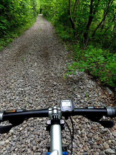
Ok, so that’s a little reverse plot for the day. Now let me take it from the bottom of the day, the start. Kind of a Groundhog Day as far as the morning went: up at 5:45; worked while Judy did a run; ate breakfast; loaded the van; took off at 7:30 AM. Our drive back to yesterday’s end point, exit 175 on I-70 west, was about 40 miles. So I got going on the bike at 8:30. Now I went L, west on Rt 152, Old Highway 6. I knew I’d have to do berm, OR if it was terrible I’d have to ride on asphalt, yea, just what I wanted! But when I got going, with Judy doing support on the up ahead of me, we found that the road was this slurry of rotted asphalt and gravel. They must be reverting the road back to gravel as is being done in many states. So I was feeling pretty lucky. Finally the gazetteer being wrong was working to my advantage. But this only lasted for a mile and then it reverted back to good asphalt. Now I was in a pickle, having felt all giddy about the gravel. So to do? I decided to ride off the road about 10, to sometimes 100 feet on this cattle track, more of a game trail kind of thing. It was rough, bumpy, crunchy with dead vegetation, rutted from washouts, and filled with rocks and debris, but by God I could ride on it.
And that’s my criteria, is it safe, and is it ridable, ie. faster than like 3 or 4 mph? Yes, and yes to those two questions for the cattle trail. Easy? Nope, it was ugly. I had to activate both shocks, and just kind of stand through a lot of sections due to the ruts and washouts. There were times where this little trail would venture out 20-30 feet from the road, going right into this fine, silty, dried mud surface. It reminded me of what you see in the Badlands, this fine, silty, dried mud. It’s just a tad soft, so you feel the tires kind of pushing the crust downward as you ride across it, so it definitely has some give. But it’s solid alright, and ridable. Hell, felt as though I was “bikewhacking” west to Green River.
I did this for a whopping 8 miles. And let me tell you, it was slow and laborious, but by gosh it was my vengeance for that first day of riding asphalt in UT back on Monday! Then as if a gift from heaven, the RR that goes right into Green River, kind of paralleling the road , well it X’ed over the road I was riding along. Now I knew this was the case, but I didn’t know if I could ride on the RR or not. It was my trump card if it was good. Was it ridable or was it even worse that my current hell? So I rode up this embankment to get some 15 feet above the road and up onto the RR trestle. And be darned if there wasn’t this nice fill of ballast between the ties, and this wonderful little single track trail in the ballast on the left hand side of the tracks. I had my choice. Man, I was on that puppy like a dog on a hambone! Started by riding right down the middle of the tracks, then a few miles in, since we’d seen an Amtrak train racing down this thing earlier when we first got on I-70, I deferred to the single track off to the side. Having ridden Amtrak, I know those guys can do 80-90 mph on the flats. That’s mpg a lot of time to react as I’m rumbling down the middle of the track.
Was able to bump my mph up to 10-11 for the rest of the way to Green River. Now I did get off the tracks and back onto the road to let Judy know that I was going to have her drive through the city, going on Rt 19 east to west and meet me at the last gas station, located on the outskirts of town on the entrance ramp to I-70 west, while I’d continue down the RR, X’ed the Green River on a trestle, then get on all this ATC tracks I’d seen on google maps that go west along the RR to that final gas station.
This worked perfectly. I rode the RR into town, across the Green River and then dismounted, walked the bike down an embankment to this gravel-dirt road, and then took this west to the ATC tracks that led out of town. Met Judy at the gas station for some water, and then we plotted out the next segment, at 15+ mile trek on this lonely old mining road that trends west, kind of paralleling I-70 and junctioning with the interstate very close to where the San Rafael Swell juts up out of the earth like this 500 foot high wall of rock. It’s a hogback on steroids, and it’s a very famous rock formation here in the UT.
So I got going on this ATC dbl track out of Green River. It kind of parallels I-70 and the RR for several miles and then dead ends into Four Corners Mine Rd. Went L, southwest on FCMR, and then began the long, circuitous trek on this desert plateau. By this time the temp was really starting to have an impact on me. This heat out here is just amazing. You feel like you’re in a frying pan while on the gravel roads, as they just reflect that sun right back onto you. But I had plenty of water, and I had my backpack with all the necessary gear in case of trouble. There’s a point where this road just trends to the northwest, and you see I-70 just disappear.
Once the road does this hard dogleg to the left, back in a southwesterly direction you come into this old abandoned mining site, Four Corners Mine, where there’s a sign warning of the potential for radon poisoning. Nice huh? I accepted the warning and rode on through the mine area, through rocky washouts, ruts, and tough stretches of beach sand that just sucked the life out of my speed. Almost walked a few sections the sand was so thick. With just about 1 mile to go I see Judy driving up this wicked road. She was worried about me being too long on the section. Told her to turn it around asap, so as not to go up into the washes and the sandy sections. Then I continued back to the interstate at exit 149. For a brief few moments Judy didn’t come back behind me, and I stated to stress about her backing the van up in all that sand and getting the van buried. But several minutes later she arrived back at the exit.
My big decision for the next segment was this, do I ride berm for 5 miles south on Rt 24 to get to get in back of Shadscale Mesa and a couple of trails that will take me back to the north, under I-70, and smack dab to the eastern trailhead of the Black Dragon Canyon Trail, my next segment, OR do I just do 2 miles of berm along I-70 to the Black Dragon Canyon trailhead? The former is a whopping 15 miles of riding. The latter is just 2 miles, but berm. My vote was for the berm, and Judy concurred. So I had Jude drive to this little gravel pull-off just past the San Rafael River that leads to the trailhead. I got on the entrance ramp, and just rode off to the side of the road on the dirt and through the vegetation. Actually, it was exactly like riding off to the side of Old Highway 6 that I’d done in the morning. So that was a really time-saving decision. The other route would have likely had some spectacular sights, as it trends along this famous area called “The Squeeze”, this 4WD track right up against the Swell. Down side was that it would likely have taken me 2-3 hrs due to the really tough terrain up there.
Anyway, I rejoined Jude in a paltry 15 minutes. And this is where I started the blog. So I got to this trailhead access road, set my bike against the van, hopped in, and began looking at the maps to see what the best approach to this trail was. This is a tough cookie in the initial for 5-8 miles as it climbs right up through the swell on some pretty challenging track. I decided that since it was already early afternoon and quite hot, that my best bet was to ride it from west to east, to link what I’d just ridden. This would be time saving and WAY easier than to climb that puppy in the heat of the day. So I just told Judy to drive me up to exit 131, where I’d get out and ride down Swell back to that eastern trailhead. We took off, with me totally forgetting that I hadn’t loaded my bike in the van, and BAM! It hit me like a freight train when we got within spitting distance of the exit.
So there you are. Just call me Numbnuts! All worked out, except that I only put in 37 miles of riding today, ending at the eastern trailhead to the Black Dragon Canyon. Still had 4 hrs of riding in, so it’s not like I took the day off. Still, my progress is just like that of a snail on this trip. If it’s not one thing, it’s just another. Now I’ve got some really challenging riding for tomorrow and part of Saturday. These are all BLM tracks, 4WD tracks and trails that somewhat parallel I-70 west. This will be at least 70+ miles of tough riding. On the interstate it’s 58 miles from the Black Dragon Canyon area, mile marker 147, west to exit 91 at the Rt 10 junction, but on my circuitous tracks, it’s much more.
Problem is that there is zero services for the 101 miles between Green River and Salina, so Saturday is going to be a whopper of a commute to the day’s start area. As I’ve said numerous times, half the difficulty of this trip is the logistics. This is one of many examples.
Tomorrow I’m going to institute a new policy: I’ll have a 3 foot long piece of perlon cord attaching me to my bike. No more mishaps!