
Monday, July 27: With me taking off from the hotel today, which is quite unusual 99% of the time, I was a bit less harried about getting on the road this morning. So by the time all the morning details were wrapped up I was ready to roll at 8:30 AM. I was certain this was going to be a bit of a nasty segment just because most of the road, or should I say tracks, are just so tough to find out here where there are just thousands of these ATC tracks with zero signage.
Last night I had to make a itinerary list for Judy as well as myself. So what I did was a reroute of my original itinerary. Originally I had the route going south to Richfield, UT, and then on this long southwesterly track through the Pahvant Mts. But the more I looked at it the more I began to see if I could save us a whole lot of riding for me by crossing that same mt range in a more northwesterly route. Because I’m heading north once across the range anyway, so why should I go so far south only to ride north again? I’d been looking at this for a week or two, but had to wait until we got here to actually see what the situation is first hand.
Found out what with these OHV trails that it is possible to link up to a northerly route across the range. So I changed the itinerary a bit ago, and then over the past couple days shored up the viability of doing it from Salina by including these OHV trails. My eyes are pretty sore from staring at my maps and the google maps on the computer. But I believed that I got it down. Today would be a short ride day, but a tough mapping/route locating day. I knew this for sure just because of all these tracks out here.
Anyway, I gave Judy this one page list of directions and sent her off to meet me on Lost Creek Rd. I took off north on that Paiute Trail, X’ed Rt 50 and then chose my best track to the west across these foothills. It was a total cluster^&%^# maze of ATV trails. I mean there was not one piece of signage. So what I did was just navigate by the sun and the topography, knowing that I had to trend to the southwest down to the town of Aurora along the Sevier River. So I rode up to these 3 cell towers on the highest point of this foothills area, and kind of lined up the sun, my shadow and hunted for the line of foliage that runs along the river.
Just as I was getting a handle on my trend, Judy called. She was on Lost Creek road, but could not find the junction point we were supposed to meet at. So I told her to just wait somewhere on Lost Creek, and when I get a bead on where to ride to find it, I’d give her a call. Began riding down the western side of the foothills on a track and be darned if I didn’t pick just the right one because as I was descending down towards the river, way down there I saw Judy turn around in the van. Called her really quick and said, “don’t move, I’ll be down in about 10-15 min.” Got down to Lost Creek road and began riding southwest.
Well, as Judy had found, and I was soon finding out, the road signage and the gps’s didn’t mesh at all, not hers, not mine. So all these turns we needed to do, they were under different names and numbers. At this point in the trip neither of us were surprised, it’s all just part of the game now. So we continued on what we thought was Sage Creek Rd, and I just rode and rode and rode, until I got down to junctioning with I-70, and that’s when I knew we were both off course. Judy came back to tell me what I’d already discovered. We loaded the bike back into the van and we drove the 4 miles we went out of the way, back up to where we must have made the gaff. Turns out my silly little phone’s gps app. actually had the right signage names/numbers. I used that to do the remainder of the ride into and through Aurora.
Got off where we screwed up and began riding again, this time taking a R on 2050S, to a L on Rt 24 for a short berm ride, to a R on Rt 160 berm and then a quick L, on 3550S. We took this just about a mile up into the foothills of the Pahvant Mts, just west of Aurora. At this point I had Judy turn around and go out to Rt 50 to meet me at the junction of FR102 and Rt 50. The remainder of this mess was going to be mine to experience! I got rolling on this long gradual middle ring climb up 3550S through the foothills. Gained some elevation pretty damned quick.
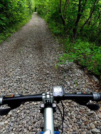
Next, and I bloody well memorized this darned series of turns and tracks from last night just in case of zero signage, was a L, north on Frog Flats Rd. So I counted the roads as I climbed and came to what should be my L turn. Got out my phone gps because my Gamin with a $100 CO/UT micro-sd card of topo USA 24K read “riding on unnamed road!” And I say this because I think this is total bullshit! I pay all this money for a fancy, high tech gps and my damned phone is better at telling me where the hell I’m at. While my phone tells me I’m on….guess….Frog Flats Rd! So I made the turn and did this wicked series of little cookie climbs, one of which I threw a chain into the spokes. These things were just screamers.
This thing finally topped out, onto a flats of sorts in the foothills. Guess that’s why they call it Frog Flats? Ok, then more turns up here on tracks that just criss cross each other like a spiderweb. My notes told me to take Frog Flats Rd until it takes a hard R turn and at the apex of this are 2 lefts, and to take the second left. So I did that and things seemed to be going well. Now at this point this track is just a track with no name, as are the rest. My next check point to make sure I was riding in the right direction was when I passed a track to the R about a quarter mile up. Did that. Then I needed to take a L at the first Y and a R at the second Y. Did both of those and things looked good. My phone gps showed me I was indeed on the right track…and my Garmin, well as usual it told me I was riding on unpaved road.
Now after that second Y, I knew to just ride this track straight, due north the rest of the way up to its junction with FR102. Slowly this track just disintegrated into almost a “ghost” track, barely visible dbl track, and then at the Xing with another track, it just disappeared. And I mean it was gone, despite the fact that, and you’ll just love this, despite the fact that both my phone gps, and my garmin gps indicated that there was a road there. It was freaking trackless desert!
Ok, so I walked the gps’s along this invisible track, and be damned if they both said I was on a track of some sorts, yet there I was walking through sage brush, rock, sand and desert. Got the bike and walked up to this high point, where this invisible track was supposed to go. Couldn’t see a thing. And that track I’d crossed, hell it trended to the south, so that was no good. I decided to hike-a-bike to the east, knowing I’d pick up Rt 50 somewhere along the line. Off I go, hike-a-biking, and be damned if not more than 200 yards down is this freaking deep wash I have to get across. And that brought back memories of all my stream Xing in Ohio.
That thing took a good ten minutes to get down into and back up out of. So much for my short day! Got across that and found this faint track which trended to the east-west, so first took it west to see if maybe that original track picked back up. Went about a half mile, got out the phone gps and checked my position. That original track was nowhere. Went back to the east and just became resigned that I was just going to ride back to Rt 50 and see how far off I was from my original destination. So I go a bit on this and be darned if I didn’t come across this Paiute OHV trail. BINGO! Now I was getting somewhere.
And just as I was ready to make the L on the Paiute I went to flip my sunglasses down….and they weren’t there. I’d left them on the ground that last time I checked my phone gps. What a dipshit! I was so mad at myself that I was cursing out loud - loudly! Now I’m a sucker for nostalgia, and those particular sunglasses, well, I’ve crossed North America 4x with those on, and I was NOT about to just ride off this late in the game. So I rode the mile back on that crappy, barely visible track, uphill, to where I’d stopped to take a gps reading. Did the ride back, retrieved the glasses and then rode back to the Paiute track.
Took this north to where I figured I’d junction with FR102, and within 3 miles that’s indeed what happened. And once again, that garmin had now *^*&%&$# idea what road I was on (riding on unpaved road), yet my phone gps said it was FR102. Amazing? So I rode this 102 descent back down and met up with Judy at the junction of FR102 and Rt 50, about 8 miles northwest of Salina.
Wow, that little jaunt is exactly why I did not try to combine today and tomorrow into one ride. I mean my total mileage for the day was 20, with about 1.4K in elevation gain, and that took me nearly 4 bloody hrs to complete. Yup. This was my “set-up” ride for tomorrow, where I’ll ride across the mts to the town of Filmore, UT. That ride alone I’m predicting at 4-6 hrs, so I’m very glad to have gotten this navigating nightmare out of the way today.
Sure hope tomorrow goes better. At least I only have 3 roads/tracks to ride on instead of the absolute mess I had today. On second thought….this is American Dirt, so tomorrow will probably be another grunt, grind, thrash, and pain-fest. Adios………pete